File:KYphysiography.svg
Jump to navigation
Jump to search

Size of this PNG preview of this SVG file: 800 × 353 pixels. Other resolutions: 320 × 141 pixels | 640 × 282 pixels | 1,024 × 452 pixels | 1,280 × 565 pixels | 2,560 × 1,130 pixels | 1,099 × 485 pixels.
Original file (SVG file, nominally 1,099 × 485 pixels, file size: 478 KB)
File history
Click on a date/time to view the file as it appeared at that time.
| Date/Time | Thumbnail | Dimensions | User | Comment | |
|---|---|---|---|---|---|
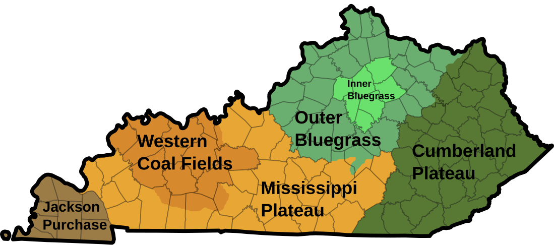
| current | 05:53, 8 July 2024 | | 1,099 × 485 (478 KB) | commons>TheWanderingTraders | {{Information |Description={{en|I created this image using Wikipedia's map of Kentucky counties. *Dark green - Eastern Kentucky Coal fields (Cumberland Plateau) *Green - Outer Bluegrass *Light green - Inner Bluegrass *Light brown - Mississippi (Pennyroyal) Plateau *Brown - Western Kentucky Coal Field *Dark brown - Jackson Purchase / en:Gulf Coastal Plain }} |Source=Own based on: File:Kentucky time zones.svg |Date= |Author={{AutVec|Lamontacranston|TheWanderingTraders|3=KYphysiography... |
File usage
There are no pages that use this file.