File:Japan trench topographic.png
Jump to navigation
Jump to search

Size of this preview: 600 × 600 pixels. Other resolutions: 240 × 240 pixels | 480 × 480 pixels.
Original file (800 × 800 pixels, file size: 221 KB, MIME type: image/png)
File history
Click on a date/time to view the file as it appeared at that time.
| Date/Time | Thumbnail | Dimensions | User | Comment | |
|---|---|---|---|---|---|
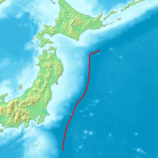
| current | 08:56, 6 October 2007 | | 800 × 800 (221 KB) | commons>Pekachu | {{Information |Description= Map of the Japan Trench(a trench near the east coast of Japan). |Source=Image:Topographic30deg_N30E120.png, [http://www.jishin.go.jp/main/p_hyoka02_kaiko.htm Headquarters for Earthquake Research Promotion homepage] |Date= |
File usage
There are no pages that use this file.