File:Jan Mayen topography-fr.png
Jump to navigation
Jump to search

Size of this preview: 765 × 600 pixels. Other resolutions: 306 × 240 pixels | 612 × 480 pixels | 980 × 768 pixels | 1,280 × 1,004 pixels | 2,560 × 2,007 pixels | 3,163 × 2,480 pixels.
Original file (3,163 × 2,480 pixels, file size: 532 KB, MIME type: image/png)
File history
Click on a date/time to view the file as it appeared at that time.
| Date/Time | Thumbnail | Dimensions | User | Comment | |
|---|---|---|---|---|---|
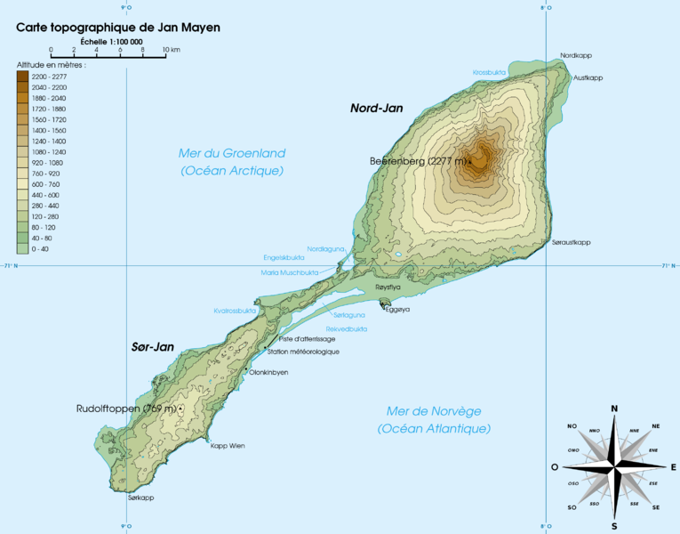
| current | 18:32, 30 April 2007 | | 3,163 × 2,480 (532 KB) | commons>Rémih | {{Information |Description={{fr|Carte topographique de l'île de Jan Mayen, Norvège}}{{en|Topographic map of Jan Mayen, Norway}} |Source=œuvre personnelle / own work |Date=30 avril 2007 |Author=Rémih |Permission={{GFDL-self}}{{cc-by-sa} |
File usage
There are no pages that use this file.