File:Jameson Land topography.png
Jump to navigation
Jump to search

Size of this preview: 800 × 362 pixels. Other resolutions: 320 × 145 pixels | 640 × 289 pixels | 1,115 × 504 pixels.
Original file (1,115 × 504 pixels, file size: 634 KB, MIME type: image/png)
File history
Click on a date/time to view the file as it appeared at that time.
| Date/Time | Thumbnail | Dimensions | User | Comment | |
|---|---|---|---|---|---|
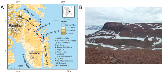
| current | 19:45, 3 October 2023 | | 1,115 × 504 (634 KB) | commons>FunkMonk | {{Information |description=Topographic map of Jameson Land, central East Greenland. (A) Topographic map of Jameson Land. The Macknight Bjerg site of the Malmros Klint Formation is marked by the red circle and number 2. Modified from [25]. (B) Photograph of the outcrops in Buch Bjerg “Track-site”. |date=2021 |source=[https://www.mdpi.com/1424-2818/13/11/561 Issi saaneq gen. et sp. nov.—A New Sauropodomorph Dinosaur from the Late Triassic (Norian) of Jameson Land, Central East Greenland] |auth... |
File usage
There are no pages that use this file.