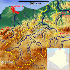
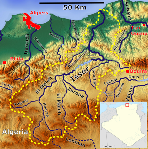
File:Isser Basin OSM.png
Jump to navigation
Jump to search

Size of this preview: 595 × 600 pixels. Other resolutions: 238 × 240 pixels | 476 × 480 pixels | 843 × 850 pixels.
Original file (843 × 850 pixels, file size: 1.32 MB, MIME type: image/png)
File history
Click on a date/time to view the file as it appeared at that time.
| Date/Time | Thumbnail | Dimensions | User | Comment | |
|---|---|---|---|---|---|
| current | 09:33, 21 January 2024 | | 843 × 850 (1.32 MB) | commons>Peter in s | == {{int:filedesc}} == {{Information |description ={{en|1=The Isser River catchment OSM, Based up on US Army map NI31, NJ31 }} |date =2024-01-21 |source =https://maps-for-free.com/, https://maps.lib.utexas.edu/maps/imw/ |author =Hans Braxmeier & Peter in s, Location map:Sting }} {{cc-by-sa-2.0}} Isser Category:Maps of rivers of Algeria Category:Isser River |
File usage
There are no pages that use this file.