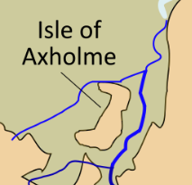
File:Isle of Axholme cropped.png
Jump to navigation
Jump to search
No higher resolution available.
Isle_of_Axholme_cropped.png (213 × 205 pixels, file size: 21 KB, MIME type: image/png)
File history
Click on a date/time to view the file as it appeared at that time.
| Date/Time | Thumbnail | Dimensions | User | Comment | |
|---|---|---|---|---|---|
| current | 13:03, 23 August 2022 | | 213 × 205 (21 KB) | commons>Harold9595959 | Uploaded a work by Hel-hama from A map of Lindsey, made using information from OpenStreetMap, Hill 'An Atlas of Anglo-Saxon England' and Stenton, 'Anglo-Saxon England' (cropped from File:Lindsey.svg) with UploadWizard |
File usage
There are no pages that use this file.