File:Ireland map County Dublin Fingal.png
Jump to navigation
Jump to search
No higher resolution available.
Ireland_map_County_Dublin_Fingal.png (163 × 120 pixels, file size: 4 KB, MIME type: image/png)
File history
Click on a date/time to view the file as it appeared at that time.
| Date/Time | Thumbnail | Dimensions | User | Comment | |
|---|---|---|---|---|---|
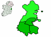
| current | 20:22, 19 March 2009 | | 163 × 120 (4 KB) | commons>File Upload Bot (Magnus Manske) | {{BotMoveToCommons|en.wikipedia|year={{subst:CURRENTYEAR}}|month={{subst:CURRENTMONTHNAME}}|day={{subst:CURRENTDAY}}}} {{Information |Description={{en|County Dublin map with inset location on island of Ireland. Also administrative divisions, with Fingal |
File usage
There are no pages that use this file.