File:Indicator map for Kamikawa and Sorachi Subprefecture in Hokkaido Japan.svg
Jump to navigation
Jump to search

Size of this PNG preview of this SVG file: 612 × 387 pixels. Other resolutions: 320 × 202 pixels | 640 × 405 pixels | 1,024 × 648 pixels | 1,280 × 809 pixels | 2,560 × 1,619 pixels.
Original file (SVG file, nominally 612 × 387 pixels, file size: 6 KB)
Summary
| Description |
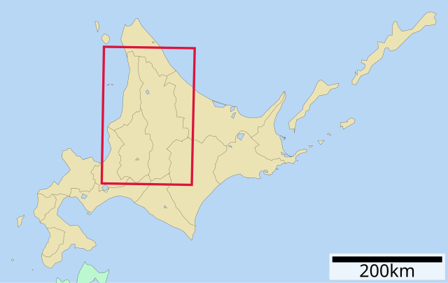
日本語: 北海道上川総合振興局位置図 |
||||
| Date | |||||
| Source | Uploaded by Lincun to Japanese Wikipedia. | ||||
| Author | Lincun | ||||
| Permission (Reusing this file) |
This file is licensed under the Creative Commons Attribution-Share Alike 3.0 Unported license.
|
||||
| Other versions | ファイル:日本地域区画地図補助 01450.svg |

Original upload log
| This file was moved from Japanese Wikipedia.
See below for original file information. | ||||||||||||||||||||||||
| ||||||||||||||||||||||||
|
| ||||||||||||||||||||||||
File history
Click on a date/time to view the file as it appeared at that time.
| Date/Time | Thumbnail | Dimensions | User | Comment | |
|---|---|---|---|---|---|
| current | 02:35, 2 December 2009 | | 612 × 387 (6 KB) | commons>ASDFGHJ | {{Information |Description= {{ja|北海道上川総合振興局位置図}} |Source= Uploaded by Lincun to Japanese Wikipedia. |Date=5 October 2009 |Author=Lincun |Permission={{GFDL-ja|migration=relicense}} |other_ve |
File usage
There are no pages that use this file.