File:India literacy rate map.svg
Jump to navigation
Jump to search

Size of this PNG preview of this SVG file: 530 × 599 pixels. Other resolutions: 212 × 240 pixels | 425 × 480 pixels | 680 × 768 pixels | 906 × 1,024 pixels | 1,812 × 2,048 pixels | 1,639 × 1,852 pixels.
Original file (SVG file, nominally 1,639 × 1,852 pixels, file size: 803 KB)
File history
Click on a date/time to view the file as it appeared at that time.
| Date/Time | Thumbnail | Dimensions | User | Comment | |
|---|---|---|---|---|---|
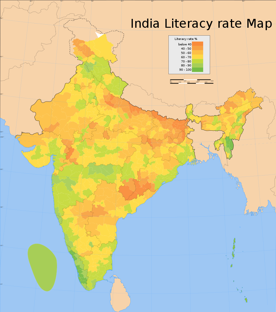
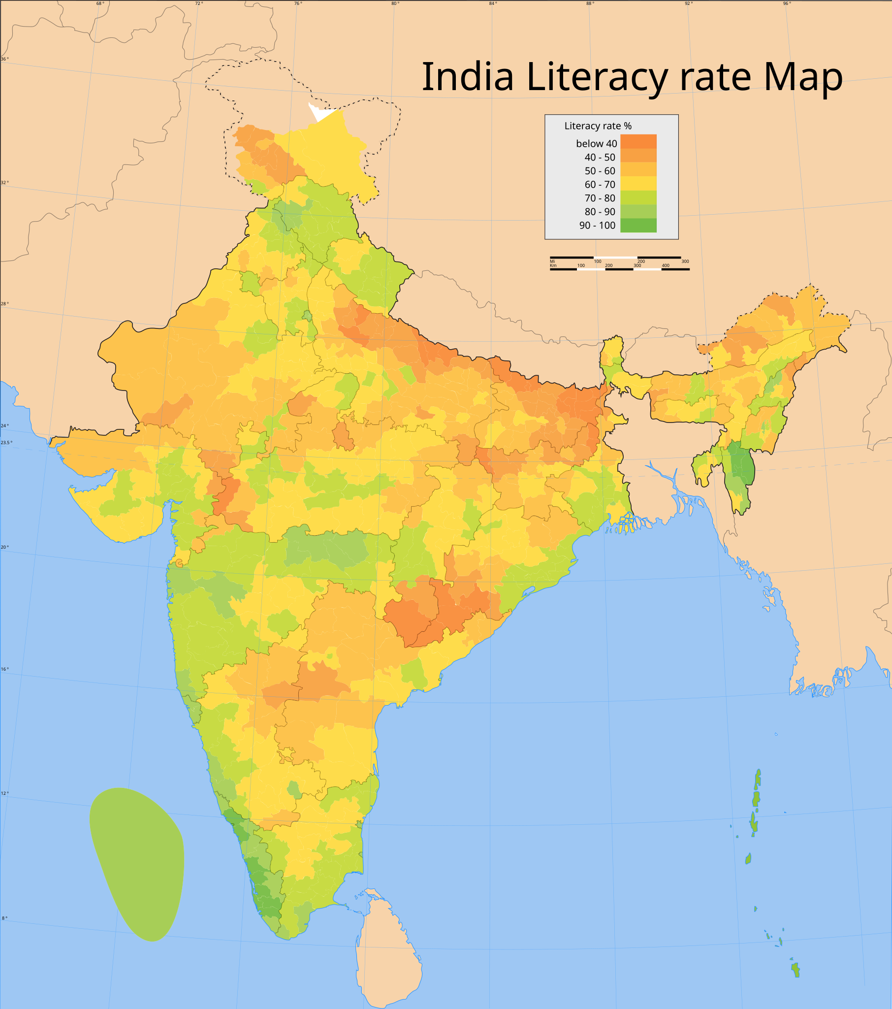
| current | 08:21, 19 October 2006 | | 1,639 × 1,852 (803 KB) | commons>Planemad | {{WikiProject_India_Maps |Title=India literacy rate map |Description=Map showing the literacy rate of each distric in India based on the 2001 census data. |Source=Census India Map site[http://www.censusindiamaps.net] - [http://www.censusindiamaps.net/page |
File usage
There are no pages that use this file.