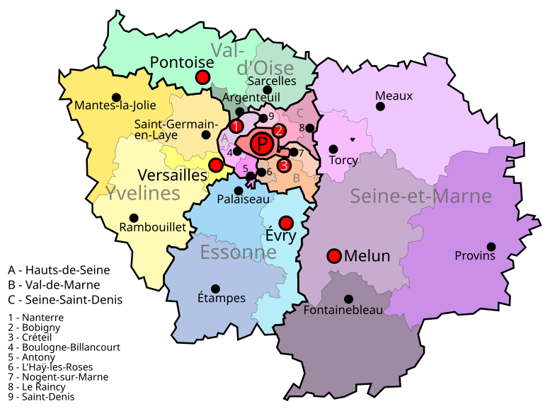
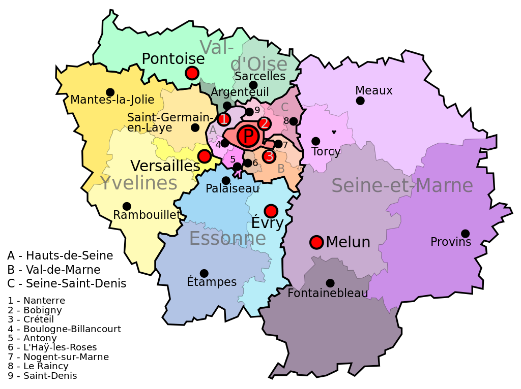
File:Ile de France.svg
Jump to navigation
Jump to search

Size of this PNG preview of this SVG file: 777 × 581 pixels. Other resolutions: 320 × 239 pixels | 640 × 479 pixels | 1,024 × 766 pixels | 1,280 × 957 pixels | 2,560 × 1,914 pixels.
Original file (SVG file, nominally 777 × 581 pixels, file size: 95 KB)
Summary
| Description |
English: Île de France map
Español: Mapa de Île de France |
| Date | |
| Source | Own work |
| Author | Jome |
| Camera location | | View this and other nearby images on: OpenStreetMap |
|---|
Licensing
| I, the copyright holder of this work, release this work into the public domain. This applies worldwide. In some countries this may not be legally possible; if so: I grant anyone the right to use this work for any purpose, without any conditions, unless such conditions are required by law. |
File history
Click on a date/time to view the file as it appeared at that time.
| Date/Time | Thumbnail | Dimensions | User | Comment | |
|---|---|---|---|---|---|
| current | 16:19, 9 July 2011 | | 777 × 581 (95 KB) | commons>AnonMoos | adjust margins |
File usage
There are no pages that use this file.