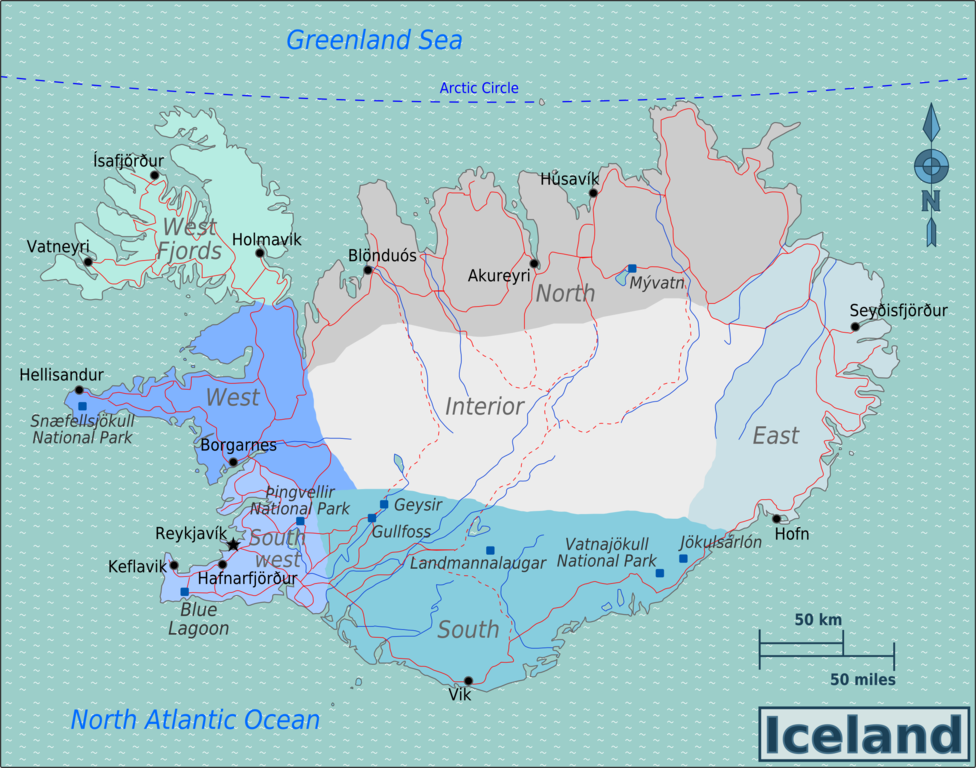
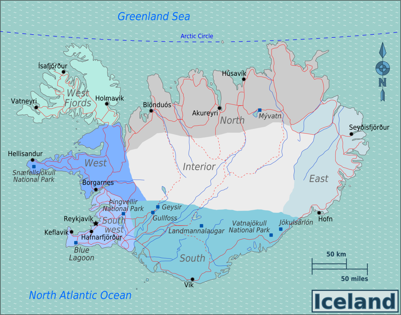
File:Iceland Regions map.png
Jump to navigation
Jump to search

Size of this preview: 762 × 600 pixels. Other resolutions: 305 × 240 pixels | 610 × 480 pixels | 976 × 768 pixels | 1,280 × 1,008 pixels | 2,501 × 1,969 pixels.
Original file (2,501 × 1,969 pixels, file size: 1.07 MB, MIME type: image/png)
File history
Click on a date/time to view the file as it appeared at that time.
| Date/Time | Thumbnail | Dimensions | User | Comment | |
|---|---|---|---|---|---|
| current | 00:07, 18 November 2012 | | 2,501 × 1,969 (1.07 MB) | commons>MGA73bot2 | {{BotMoveToCommons|wts.oldwikivoyage|year={{subst:CURRENTYEAR}}|month={{subst:CURRENTMONTHNAME}}|day={{subst:CURRENTDAY}}}} == {{int:filedesc}} == {{Information |description=Map of Iceland. Map of Iceland, Iceland * Map of: Iceland¤ |date=April 16th 2... |
File usage
There are no pages that use this file.