File:IJsselmonde osm.png
Jump to navigation
Jump to search

Size of this preview: 800 × 546 pixels. Other resolutions: 320 × 219 pixels | 640 × 437 pixels | 1,024 × 699 pixels | 1,356 × 926 pixels.
Original file (1,356 × 926 pixels, file size: 1.38 MB, MIME type: image/png)
File history
Click on a date/time to view the file as it appeared at that time.
| Date/Time | Thumbnail | Dimensions | User | Comment | |
|---|---|---|---|---|---|
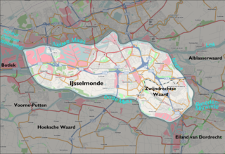
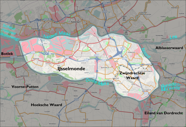
| current | 14:54, 10 November 2007 | | 1,356 × 926 (1.38 MB) | commons>Mtcv | {{Information |Description=Map of the IJsselmonde 'island' south of Rotterdam. The background map is taken from Openstreetmap.org. The boundary was drawn by me using the description in the Dutch IJsselmonde article. |Source=Openstreetmap.org ([http://www. |
File usage
There are no pages that use this file.