File:IBRA 6.1 MAL1.png
Jump to navigation
Jump to search
Size of this preview: 800 × 596 pixels. Other resolutions: 320 × 238 pixels | 640 × 477 pixels | 1,024 × 763 pixels | 1,257 × 936 pixels.
Original file (1,257 × 936 pixels, file size: 105 KB, MIME type: image/png)
File history
Click on a date/time to view the file as it appeared at that time.
| Date/Time | Thumbnail | Dimensions | User | Comment | |
|---|---|---|---|---|---|
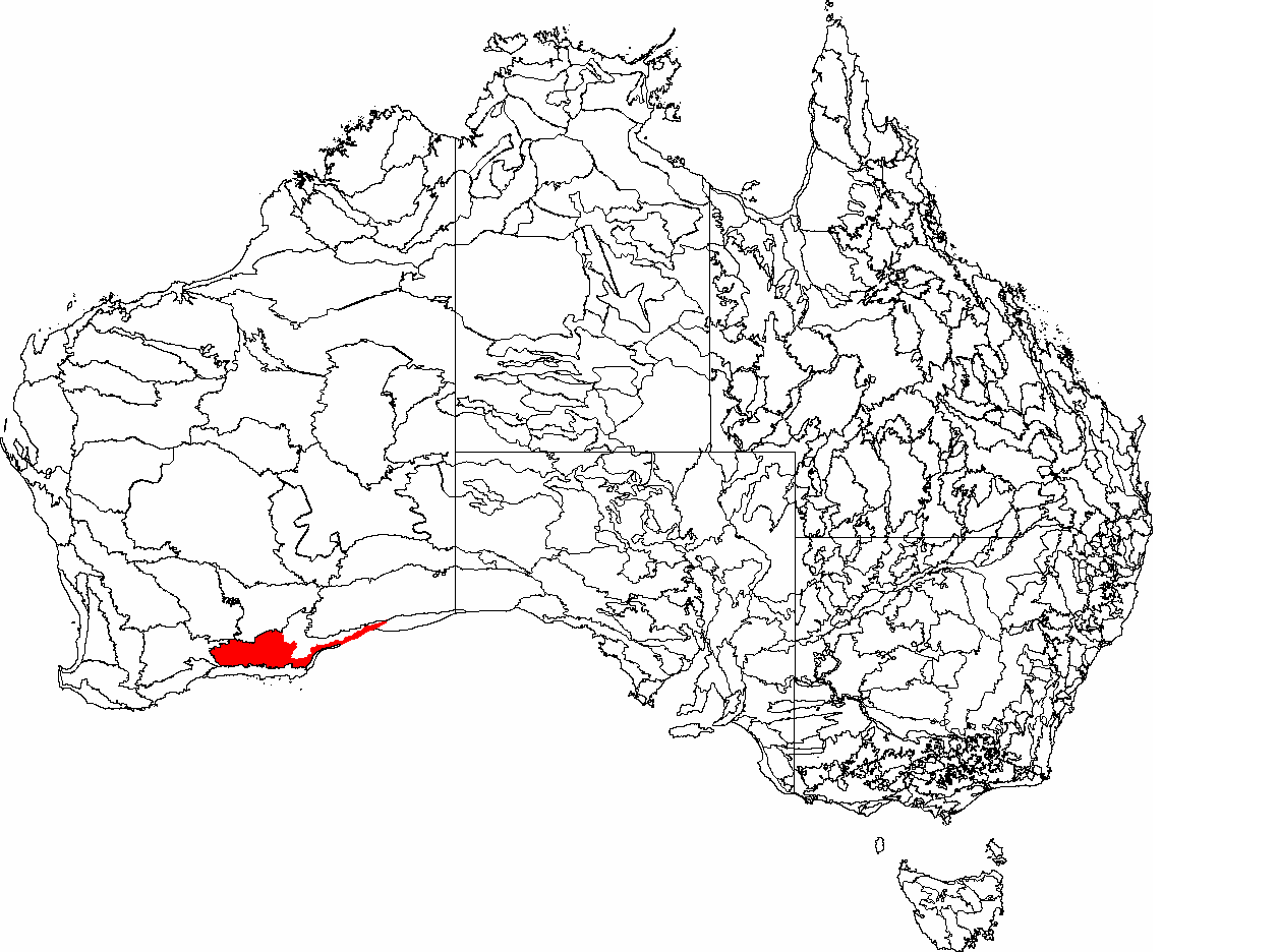
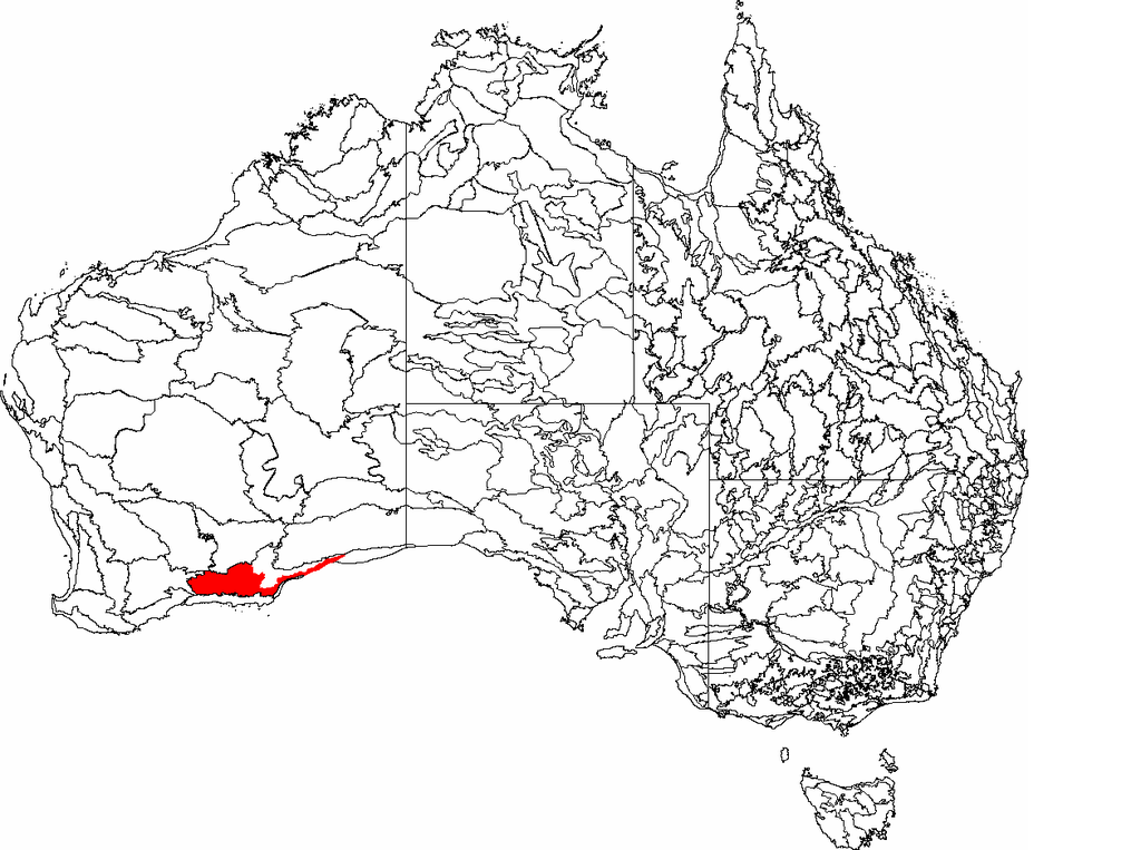
| current | 05:17, 26 April 2007 | | 1,257 × 936 (105 KB) | commons>Hesperian | {{Information |Description=This is a map of the Interim Biogeographic Regionalisation of Australia (IBRA) subregions, with state boundaries overlaid. The '''Eastern Mallee''' region ('''MAL1''') is shown in red. |Source=It was created by the uploader. |Da |
File usage
There are no pages that use this file.