File:Huntington Solano-Reeve 1858 Rancho Los Alamitos survey map.jpg
Jump to navigation
Jump to search

Size of this preview: 800 × 459 pixels. Other resolutions: 320 × 184 pixels | 640 × 367 pixels | 1,024 × 587 pixels | 1,280 × 734 pixels | 2,560 × 1,469 pixels | 7,291 × 4,183 pixels.
Original file (7,291 × 4,183 pixels, file size: 5.24 MB, MIME type: image/jpeg)
File history
Click on a date/time to view the file as it appeared at that time.
| Date/Time | Thumbnail | Dimensions | User | Comment | |
|---|---|---|---|---|---|
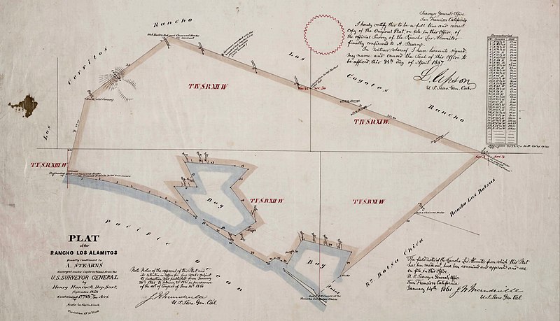
| current | 06:01, 31 March 2023 | | 7,291 × 4,183 (5.24 MB) | commons>Jengod | Uploaded a work by GLO/BLM from Title Plat of the Rancho Los Alamitos finally confirmed to A. Stearns Creator Hancock, Henry, 1822-1883, surveyor. Date Searchable 1858-09 Date 1858 September Call Number SR_Map_0006 Physical Description 1 map ; 14 x 24 in., on sheet 17 3/4 x 29 3/4 in., ink on tracing cloth Scale 1 : 40 chains [1/2 mile] Location depicted Los Alamitos Los Alamitos, Rancho Description Bordered by Los Cerritos Rancho, Pacific Ocean, Rancho Bolsa Chica, Ranchos Los Bolsas, Ranch... |
File usage
There are no pages that use this file.