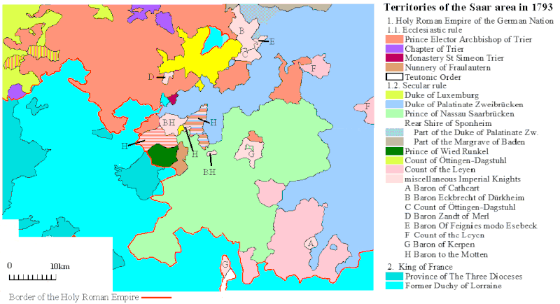
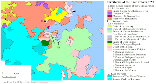
File:Historical map of the Saarland 1793.gif
Jump to navigation
Jump to search

Size of this preview: 800 × 434 pixels. Other resolutions: 320 × 174 pixels | 640 × 347 pixels | 995 × 540 pixels.
Original file (995 × 540 pixels, file size: 38 KB, MIME type: image/gif)
File history
Click on a date/time to view the file as it appeared at that time.
| Date/Time | Thumbnail | Dimensions | User | Comment | |
|---|---|---|---|---|---|
| current | 16:23, 22 March 2019 | | 995 × 540 (38 KB) | commons>Alphathon | Various minor tweaks |
File usage
There are no pages that use this file.