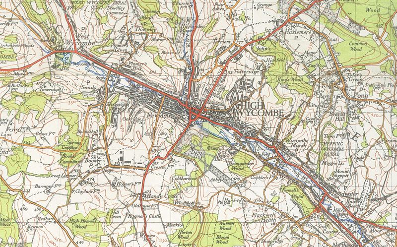
File:High Wycombe map1945.jpg
Jump to navigation
Jump to search

Size of this preview: 800 × 498 pixels. Other resolutions: 320 × 199 pixels | 640 × 399 pixels | 1,024 × 638 pixels | 1,280 × 798 pixels | 2,011 × 1,253 pixels.
Original file (2,011 × 1,253 pixels, file size: 1.94 MB, MIME type: image/jpeg)
File history
Click on a date/time to view the file as it appeared at that time.
| Date/Time | Thumbnail | Dimensions | User | Comment | |
|---|---|---|---|---|---|
| current | 23:37, 5 October 2009 | | 2,011 × 1,253 (1.94 MB) | commons>File Upload Bot (Magnus Manske) | {{BotMoveToCommons|en.wikipedia|year={{subst:CURRENTYEAR}}|month={{subst:CURRENTMONTHNAME}}|day={{subst:CURRENTDAY}}}} {{Information |Description={{en|1 inch to the mile OS map of High_Wycombe 1945 en:Category:High Wycombe}} |Source=Transferred f |
File usage
There are no pages that use this file.