File:Henry Hancock 1860 U.S. Survey map of Rancho Los Nogales Walnut Los Angeles.jpg
Jump to navigation
Jump to search
Size of this preview: 479 × 599 pixels. Other resolutions: 192 × 240 pixels | 384 × 480 pixels | 614 × 768 pixels | 819 × 1,024 pixels | 1,638 × 2,048 pixels | 4,183 × 5,229 pixels.
Original file (4,183 × 5,229 pixels, file size: 5.05 MB, MIME type: image/jpeg)
File history
Click on a date/time to view the file as it appeared at that time.
| Date/Time | Thumbnail | Dimensions | User | Comment | |
|---|---|---|---|---|---|
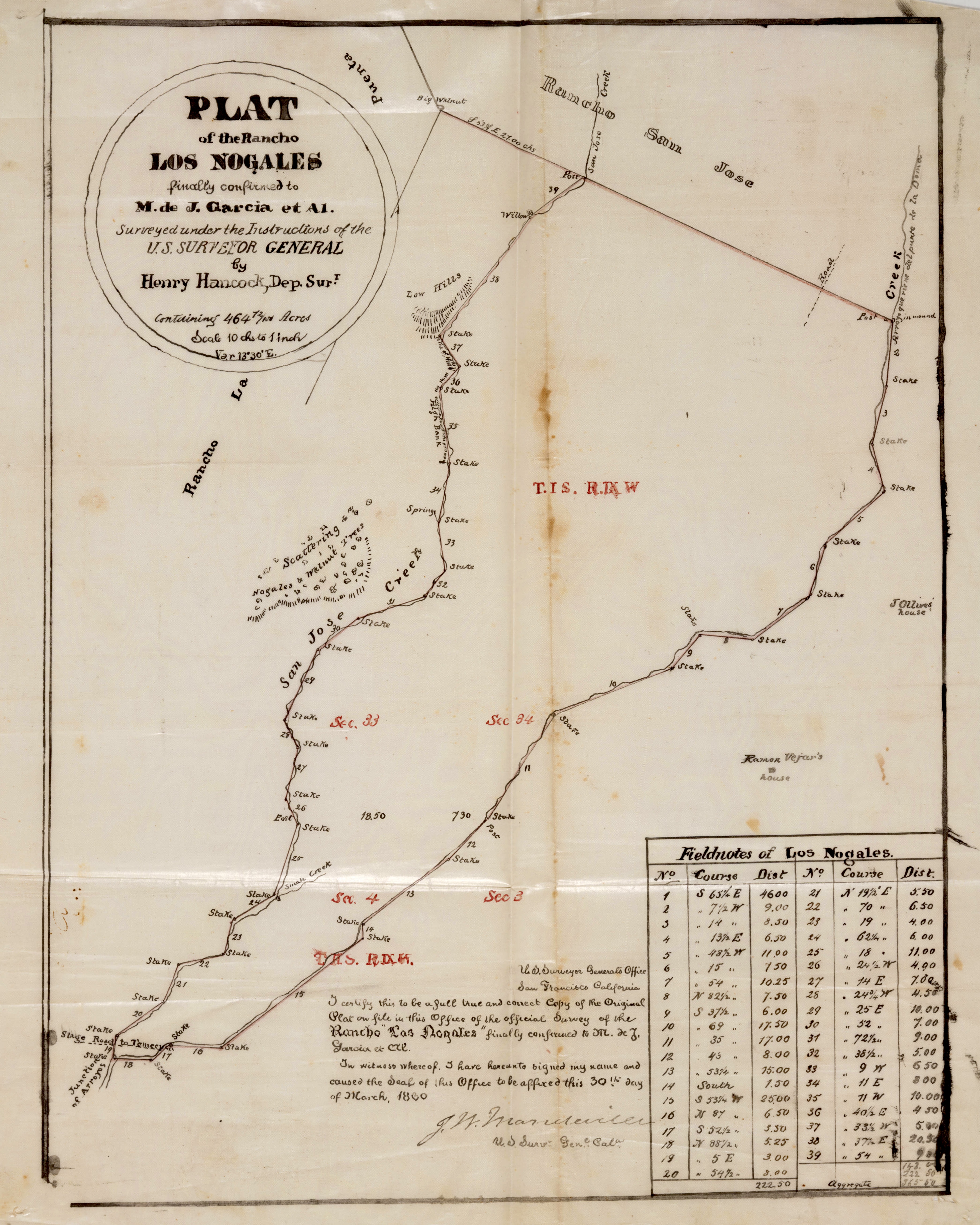
| current | 03:36, 1 April 2023 | | 4,183 × 5,229 (5.05 MB) | commons>Jengod | Uploaded a work by Henry Hancock from Title Plat of the Rancho Los Nogales. Alt Title Rancho los Nogales : plat of the Rancho Los Nogales. Creator Hancock, Henry, 1822-1883, surveyor. Date Searchable 1860-03-30 Date 1860 March 30 Call Number SR_Box_22(03).03 Physical Description 1 ms. map ; 14 1/2 x 12 in., on sheet 18 x 14 3/4 in., ink on tracing cloth Scale 1 : 10 chains Location depicted Walnut Description Bordered by Ranchos San Jose, La Puente. Attached to certification sheet; showing se... |
File usage
There are no pages that use this file.