File:HUNEBEDDEN20X LANDSAT WIKI.jpg
Jump to navigation
Jump to search

Size of this preview: 775 × 599 pixels. Other resolutions: 310 × 240 pixels | 621 × 480 pixels | 777 × 601 pixels.
Original file (777 × 601 pixels, file size: 213 KB, MIME type: image/jpeg)
File history
Click on a date/time to view the file as it appeared at that time.
| Date/Time | Thumbnail | Dimensions | User | Comment | |
|---|---|---|---|---|---|
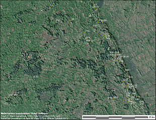
| current | 06:15, 6 July 2009 | | 777 × 601 (213 KB) | commons>Marcoaliaslama | {{Information |Description={{en|1=Shaded relief map of the location of the 53 extant Dutch 'hunebedden' (dolmens). Altitudes have been exaggerated by a factor 20 to show the relief. It can be seen that most dolmens are located on higher ground (the Hondsr |
File usage
There are no pages that use this file.