File:Greensboro-Winston-Salem-High Point CSA.png
Jump to navigation
Jump to search
No higher resolution available.
Greensboro-Winston-Salem-High_Point_CSA.png (654 × 266 pixels, file size: 40 KB, MIME type: image/png)
| Description |
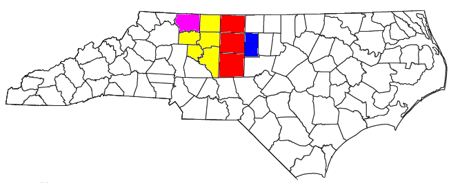
Locator map of the Greensboro-Winston-Salem-High Point Combined Statistical Area in the northern part of the U.S. state of North Carolina. The four components of the CSA are colored separately: |
||
| Date | |||
| Source |
Modified from this United States Census Bureau file, based on the following Census definitions lists:
|
||
| Author | User:Nyttend, Yassie | ||
| Permission (Reusing this file) |
US Government work is public domain, and our work is
|
File history
Click on a date/time to view the file as it appeared at that time.
| Date/Time | Thumbnail | Dimensions | User | Comment | |
|---|---|---|---|---|---|
| current | 16:31, 22 April 2013 | 654 × 266 (40 KB) | commons>Yassie | new MSA/CSA definition by OMB, 28/Feb/2013 |
File usage
There are no pages that use this file.