File:GrandCaymanMap.png
Jump to navigation
Jump to search
No higher resolution available.
GrandCaymanMap.png (800 × 395 pixels, file size: 47 KB, MIME type: image/png)
File history
Click on a date/time to view the file as it appeared at that time.
| Date/Time | Thumbnail | Dimensions | User | Comment | |
|---|---|---|---|---|---|
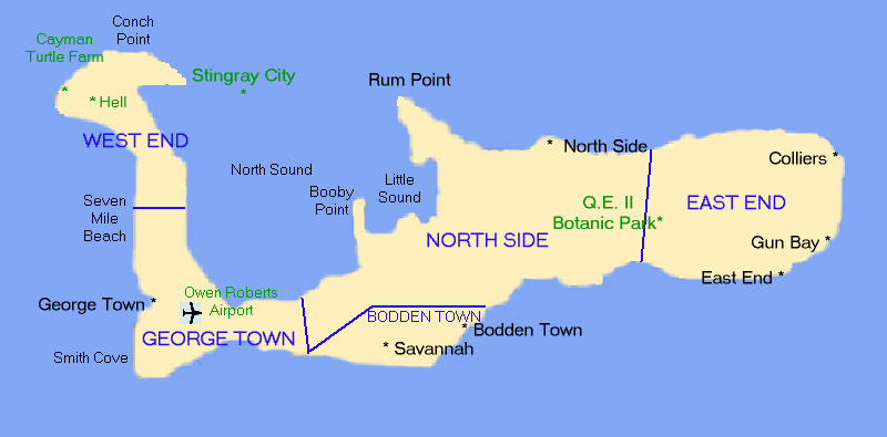
| current | 23:53, 17 November 2012 | | 800 × 395 (47 KB) | commons>MGA73bot2 | {{BotMoveToCommons|wts.oldwikivoyage|year={{subst:CURRENTYEAR}}|month={{subst:CURRENTMONTHNAME}}|day={{subst:CURRENTDAY}}}} == {{int:filedesc}} == {{Information |description=Map of Grand Cayman Island, Cayman Islands. Drawn by uploader [[:wts:User:(WT-... |
File usage
There are no pages that use this file.