File:Gough Island Map.jpg
Jump to navigation
Jump to search

Size of this preview: 800 × 583 pixels. Other resolutions: 320 × 233 pixels | 640 × 467 pixels | 1,024 × 747 pixels | 1,240 × 904 pixels.
Original file (1,240 × 904 pixels, file size: 436 KB, MIME type: image/jpeg)
File history
Click on a date/time to view the file as it appeared at that time.
| Date/Time | Thumbnail | Dimensions | User | Comment | |
|---|---|---|---|---|---|
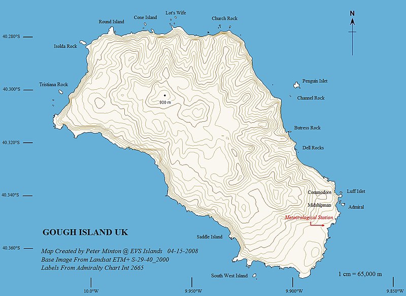
| current | 09:49, 11 March 2010 | | 1,240 × 904 (436 KB) | commons>Telim tor | == {{int:filedesc}} == {{Information |Description={{en|Topographic map of Gough Island - EVS Precison Map (1:65,000)}} |Source=[http://www.flickr.com/photos/evsmap/2418411312/in/set-72157604567187939/ flickr] |Author=Peter Minton ([http://www.flickr.com/p |
File usage
There are no pages that use this file.