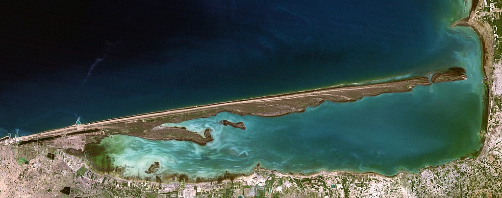
File:Gorgan Bay, Miankaleh peninsula and Ashuradeh island, LandSat-5 satellite image 01-APR-95.jpg
Jump to navigation
Jump to search

Size of this preview: 800 × 316 pixels. Other resolutions: 320 × 126 pixels | 640 × 253 pixels | 1,024 × 405 pixels | 2,472 × 977 pixels.
Original file (2,472 × 977 pixels, file size: 542 KB, MIME type: image/jpeg)
File history
Click on a date/time to view the file as it appeared at that time.
| Date/Time | Thumbnail | Dimensions | User | Comment | |
|---|---|---|---|---|---|
| current | 13:33, 14 November 2017 | 2,472 × 977 (542 KB) | commons>Bogomolov.PL | better quality version |
File usage
There are no pages that use this file.