File:Goodwin Fire.png
Jump to navigation
Jump to search

Size of this preview: 600 × 600 pixels. Other resolutions: 240 × 240 pixels | 480 × 480 pixels | 768 × 768 pixels | 1,024 × 1,024 pixels | 2,048 × 2,048 pixels | 3,200 × 3,200 pixels.
Original file (3,200 × 3,200 pixels, file size: 3.97 MB, MIME type: image/png)
File history
Click on a date/time to view the file as it appeared at that time.
| Date/Time | Thumbnail | Dimensions | User | Comment | |
|---|---|---|---|---|---|
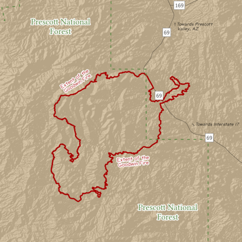
| current | 20:20, 17 February 2024 | | 3,200 × 3,200 (3.97 MB) | commons>Guerillero | == {{int:filedesc}} == {{User:Guerillero/MapTemplate |Description= {{en|Scope of the Goodwin Wildfire according to the National Interagency Fire Center.}} |Date= 2024-02-17 |WURL= |WStatus= |Projection = NAD 1983 UTM Zone 12N |Scale = 1:15,000 }} == {{int:license-header}} == ===Data and other credited works=== ====Wildfire==== [https://data-nifc.opendata.arcgis.com/datasets/ef25d7e8c9f3499ba9e3d8e09606e488_0/explore Historic Perimeters Combined 2000-2018 GeoMAC] {{PD-USGov}} ====Hillshade... |
File usage
There are no pages that use this file.