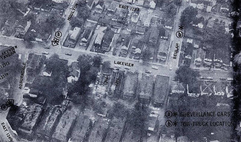
File:Glenville shootout aerial map.jpg
Jump to navigation
Jump to search

Size of this preview: 800 × 472 pixels. Other resolutions: 320 × 189 pixels | 640 × 378 pixels | 1,056 × 623 pixels.
Original file (1,056 × 623 pixels, file size: 432 KB, MIME type: image/jpeg)
File history
Click on a date/time to view the file as it appeared at that time.
| Date/Time | Thumbnail | Dimensions | User | Comment | |
|---|---|---|---|---|---|
| current | 05:40, 23 July 2023 | | 1,056 × 623 (432 KB) | commons>SteinsplitterBot | Bot: Image rotated by 90° |
File usage
There are no pages that use this file.