File:Geothermal springs map US.png
Jump to navigation
Jump to search
Size of this preview: 800 × 349 pixels. Other resolutions: 320 × 140 pixels | 887 × 387 pixels.
Original file (887 × 387 pixels, file size: 78 KB, MIME type: image/png)
File history
Click on a date/time to view the file as it appeared at that time.
| Date/Time | Thumbnail | Dimensions | User | Comment | |
|---|---|---|---|---|---|
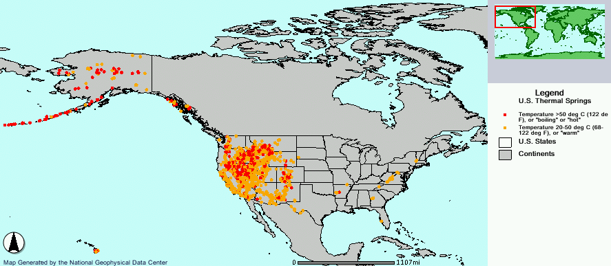
| current | 08:20, 15 February 2006 | | 887 × 387 (78 KB) | commons>Napa | Geothermal hot springs in the United States. {{PD-USGov-DOC-NOAA}} http://map.ngdc.noaa.gov/website/seg/hot_springs/viewer.htm Category:Maps of North America |
File usage
There are no pages that use this file.