File:George Mayo Map.png
Jump to navigation
Jump to search
No higher resolution available.
George_Mayo_Map.png (623 × 474 pixels, file size: 525 KB, MIME type: image/png)
File history
Click on a date/time to view the file as it appeared at that time.
| Date/Time | Thumbnail | Dimensions | User | Comment | |
|---|---|---|---|---|---|
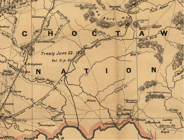
| current | 23:27, 4 June 2010 | | 623 × 474 (525 KB) | commons>File Upload Bot (Magnus Manske) | {{BotMoveToCommons|en.wikipedia|year={{subst:CURRENTYEAR}}|month={{subst:CURRENTMONTHNAME}}|day={{subst:CURRENTDAY}}}} {{Information |Description={{en|Indian territory: compiled from the official records of the records of the General Land Office and othe |
File usage
There are no pages that use this file.