File:Geologic map of Crater Lake floor.png
Jump to navigation
Jump to search
No higher resolution available.
Geologic_map_of_Crater_Lake_floor.png (477 × 544 pixels, file size: 12 KB, MIME type: image/png)
File history
Click on a date/time to view the file as it appeared at that time.
| Date/Time | Thumbnail | Dimensions | User | Comment | |
|---|---|---|---|---|---|
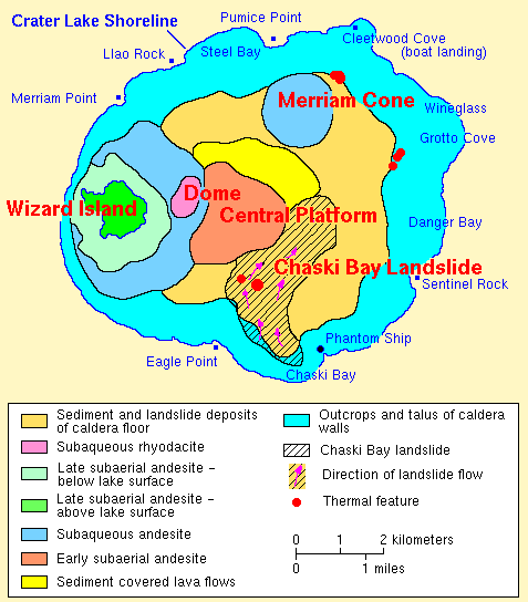
| current | 20:50, 9 April 2009 | | 477 × 544 (12 KB) | commons>File Upload Bot (Magnus Manske) | {{BotMoveToCommons|en.wikipedia|year={{subst:CURRENTYEAR}}|month={{subst:CURRENTMONTHNAME}}|day={{subst:CURRENTDAY}}}} {{Information |Description={{en|en:USGS photo from [http://vulcan.wr.usgs.gov/Volcanoes/CraterLake/Maps/map_geology_crater_lake_f |
File usage
There are no pages that use this file.