File:Geographic Map of Mexico.jpg
Jump to navigation
Jump to search
Size of this preview: 800 × 564 pixels. Other resolutions: 320 × 226 pixels | 640 × 451 pixels | 1,024 × 722 pixels.
Original file (1,024 × 722 pixels, file size: 455 KB, MIME type: image/jpeg)
File history
Click on a date/time to view the file as it appeared at that time.
| Date/Time | Thumbnail | Dimensions | User | Comment | |
|---|---|---|---|---|---|
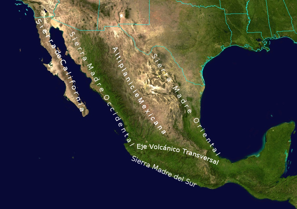
| current | 09:02, 21 December 2012 | | 1,024 × 722 (455 KB) | commons>Urdangaray | {{Information |Description={{en|Topological Map labeling the most important elevations of the country}} |Source=Transferred from [http://en.wikipedia.org en.wikipedia]<br/> (Original text : ''NASA'') |Date=8-23-10<br/> ({{Original upload date|2010-08-2... |
File usage
There are no pages that use this file.