File:Gbcounties.png
Jump to navigation
Jump to search

Size of this preview: 378 × 599 pixels. Other resolutions: 151 × 240 pixels | 302 × 480 pixels | 797 × 1,264 pixels.
Original file (797 × 1,264 pixels, file size: 88 KB, MIME type: image/png)
File history
Click on a date/time to view the file as it appeared at that time.
| Date/Time | Thumbnail | Dimensions | User | Comment | |
|---|---|---|---|---|---|
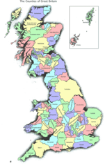
| current | 16:01, 7 November 2006 | | 797 × 1,264 (88 KB) | commons>Boivie | Historical map of Great Britain, originally from [http://www.abcounties.co.uk/ www.abcounties.co.uk] The purpose of this map is to give a reasonably accurate large-scale representation of the 86 Counties of Britain. No claim to small-scale planimetric ac |
File usage
There are no pages that use this file.