File:Gauleptolemee1541.jpg
Jump to navigation
Jump to search

Size of this preview: 791 × 600 pixels. Other resolutions: 317 × 240 pixels | 633 × 480 pixels | 1,013 × 768 pixels | 1,280 × 970 pixels | 1,612 × 1,222 pixels.
Original file (1,612 × 1,222 pixels, file size: 261 KB, MIME type: image/jpeg)
Summary
| Artist | |
| Author |
Ptolemy, translated by Willibald Pirckheimer |
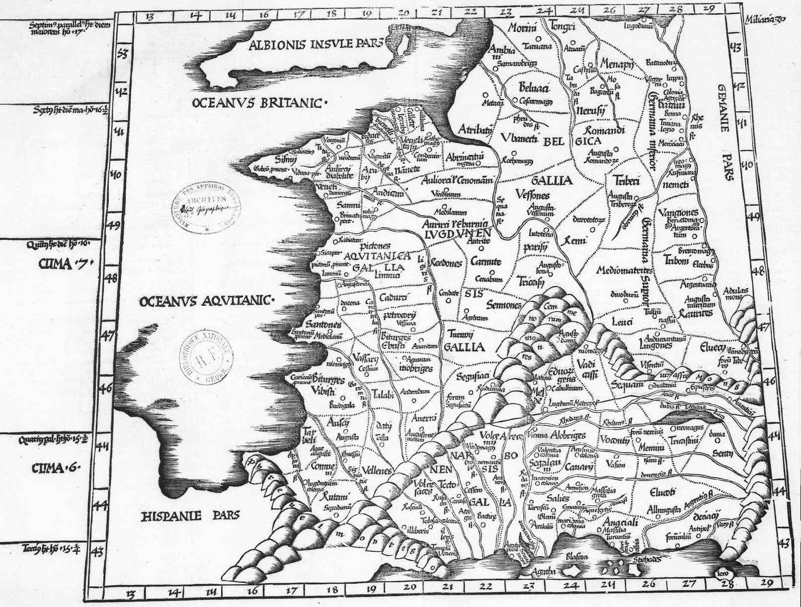
| Description |
English: The 3rd European Map (Tertia Europae Tabula) of Laurent Fries from a 1541 reprint of his 1522 maps for Ptolemy's Geography.
Français : Carte de 1541 représentant la Gaule au temps de Ptolémée |
| Date | 1541 |
| Source/Photographer | http://www.orpaillage.fr/histoire/gauleptolemee1541.jpg |
Licensing
|
This work is in the public domain in its country of origin and other countries and areas where the copyright term is the author's life plus 100 years or fewer. | |
| This file has been identified as being free of known restrictions under copyright law, including all related and neighboring rights. | |
File history
Click on a date/time to view the file as it appeared at that time.
| Date/Time | Thumbnail | Dimensions | User | Comment | |
|---|---|---|---|---|---|
| current | 20:05, 5 April 2008 | | 1,612 × 1,222 (261 KB) | commons>Thesupermat | {{Information |Description=Carte de 1541 représentant la Gaule au temps de Ptolémée |Source=http://www.orpaillage.fr/histoire/gauleptolemee1541.jpg |Date=1541 |Author=unknow |Permission= |other_versions= }} Category:Maps of Roman Gaul |
File usage
There are no pages that use this file.