File:G’ijduvon District location map.png
Jump to navigation
Jump to search

Size of this preview: 776 × 600 pixels. Other resolutions: 311 × 240 pixels | 621 × 480 pixels | 994 × 768 pixels | 1,280 × 989 pixels | 2,112 × 1,632 pixels.
Original file (2,112 × 1,632 pixels, file size: 51 KB, MIME type: image/png)
Summary
This file was uploaded with Commonist.
| Description |
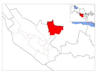
English: Location map of G’ijduvon District in Buxoro Province, Uzbekistan
Русский: Карта расположения Гиждуванского района в Бухарской области Узбекистана
Українська: Карта розташування Гіждуванського району в Бухарській області Узбекистану |
| Date | |
| Source | Buxoro_districts_empty.png |
| Author |
|
| Permission (Reusing this file) |
This file is licensed under the Creative Commons Attribution-Share Alike 3.0 Unported license.
|
File history
Click on a date/time to view the file as it appeared at that time.
| Date/Time | Thumbnail | Dimensions | User | Comment | |
|---|---|---|---|---|---|
| current | 22:20, 9 February 2011 | | 2,112 × 1,632 (51 KB) | commons>Ahonc |
File usage
There are no pages that use this file.