File:FrobisherBayOMC.png
Jump to navigation
Jump to search
No higher resolution available.
FrobisherBayOMC.png (496 × 496 pixels, file size: 17 KB, MIME type: image/png)
File history
Click on a date/time to view the file as it appeared at that time.
| Date/Time | Thumbnail | Dimensions | User | Comment | |
|---|---|---|---|---|---|
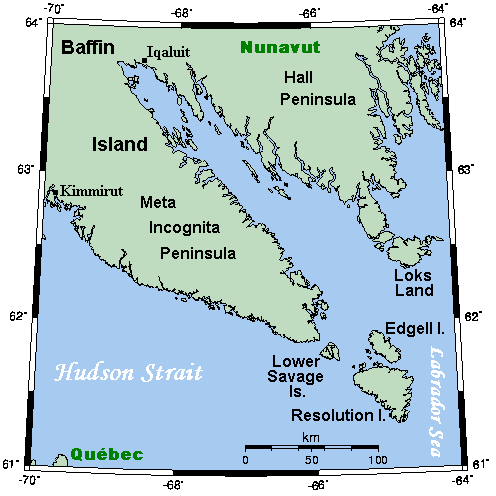
| current | 17:58, 10 July 2008 | | 496 × 496 (17 KB) | commons>Urdangaray | {{Information |Description={{en|A map showing Frobisher Bay and nearby areas. This map's source is [http://www.aquarius.ifm-geomar.de/ here], with the uploader's modifications, and the [http://gmt.soest.hawaii.edu/ GMT homepage] says that the tools are re |
File usage
There are no pages that use this file.