File:French Polynesia relief map.svg
Jump to navigation
Jump to search

Size of this PNG preview of this SVG file: 600 × 600 pixels. Other resolutions: 240 × 240 pixels | 480 × 480 pixels | 768 × 768 pixels | 1,024 × 1,024 pixels | 2,048 × 2,048 pixels | 1,260 × 1,260 pixels.
Original file (SVG file, nominally 1,260 × 1,260 pixels, file size: 1.4 MB)
File history
Click on a date/time to view the file as it appeared at that time.
| Date/Time | Thumbnail | Dimensions | User | Comment | |
|---|---|---|---|---|---|
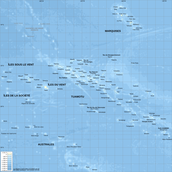
| current | 20:29, 16 October 2008 | | 1,260 × 1,260 (1.4 MB) | commons>Sardon | {{Information |Description={{en|1=Topographic map with French names of French Polynesia}} {{fr|1=Carte topographique de la Polynésie française, en français}} |Source=Own work.{{clr}} Data sources : * Background map : [http://www.ngdc.noaa.gov/mgg/globa |
File usage
There are no pages that use this file.