File:French Indochina 1937.png
Jump to navigation
Jump to search
Size of this preview: 387 × 599 pixels. Other resolutions: 155 × 240 pixels | 310 × 480 pixels | 496 × 768 pixels | 661 × 1,024 pixels | 1,292 × 2,000 pixels.
Original file (1,292 × 2,000 pixels, file size: 515 KB, MIME type: image/png)
Summary
| Description |
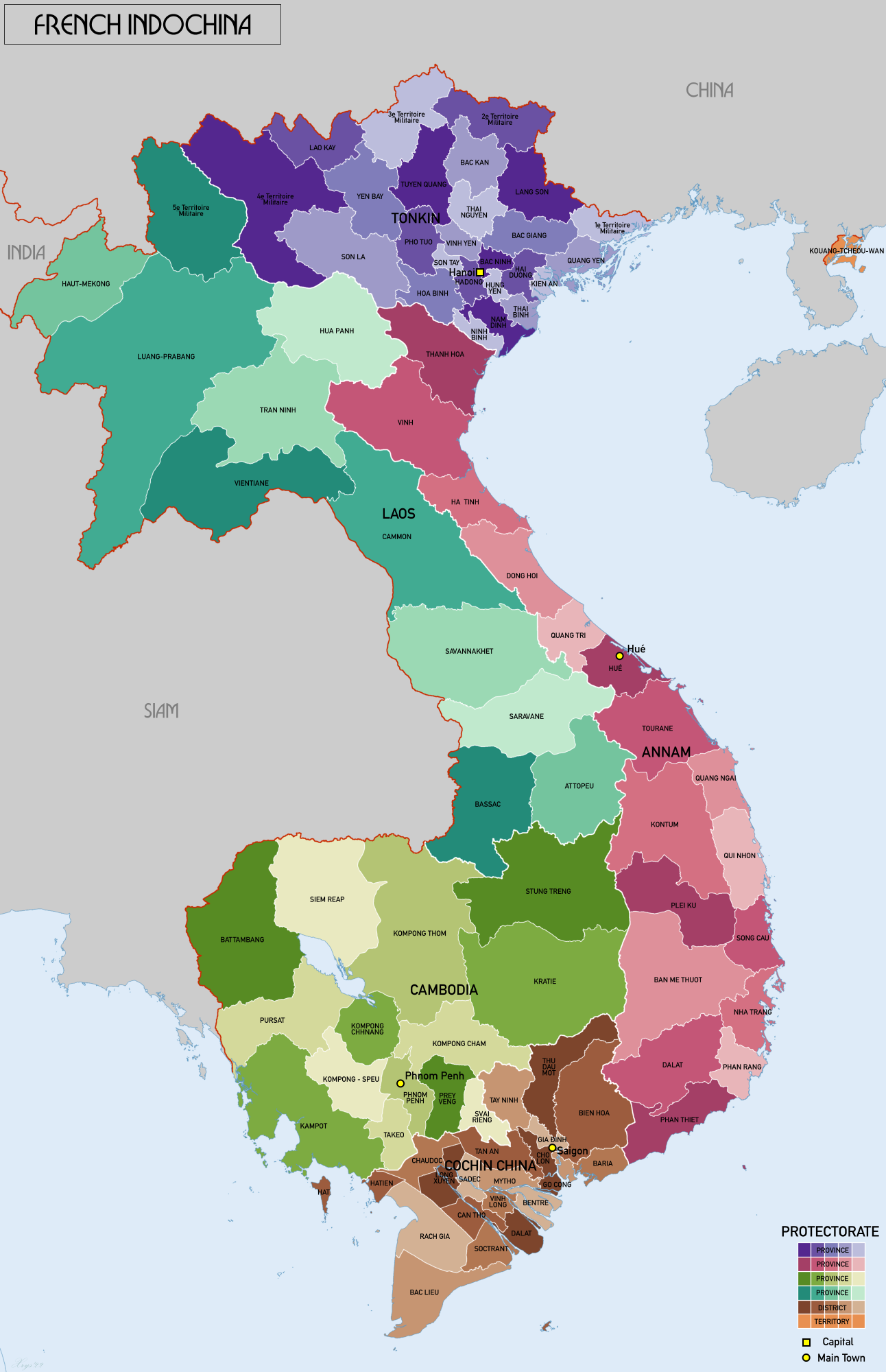
English: Administrative map of French Indochina in 1937. Showing protectorates and provinces/districts. Source map data: AMS 509 (Indochina & Thailand) 1:250k (PCL Map collection). Reseau Routier de l'Indochine 1:2m (BNF). |
| Date | |
| Source | Own work |
| Author | XrysD |
Licensing
I, the copyright holder of this work, hereby publish it under the following license:
This file is licensed under the Creative Commons Attribution-Share Alike 4.0 International license.
- You are free:
- to share – to copy, distribute and transmit the work
- to remix – to adapt the work
- Under the following conditions:
- attribution – You must give appropriate credit, provide a link to the license, and indicate if changes were made. You may do so in any reasonable manner, but not in any way that suggests the licensor endorses you or your use.
- share alike – If you remix, transform, or build upon the material, you must distribute your contributions under the same or compatible license as the original.
File history
Click on a date/time to view the file as it appeared at that time.
| Date/Time | Thumbnail | Dimensions | User | Comment | |
|---|---|---|---|---|---|
| current | 08:45, 29 August 2022 | | 1,292 × 2,000 (515 KB) | commons>XrysD | New colours. Isle of Phú Quốc to Hatien in Cochinchina. |
File usage
There are no pages that use this file.