File:Fossils that helped develop the first geological map.jpg
Original file (2,592 × 1,944 pixels, file size: 1.13 MB, MIME type: image/jpeg)
| Description |
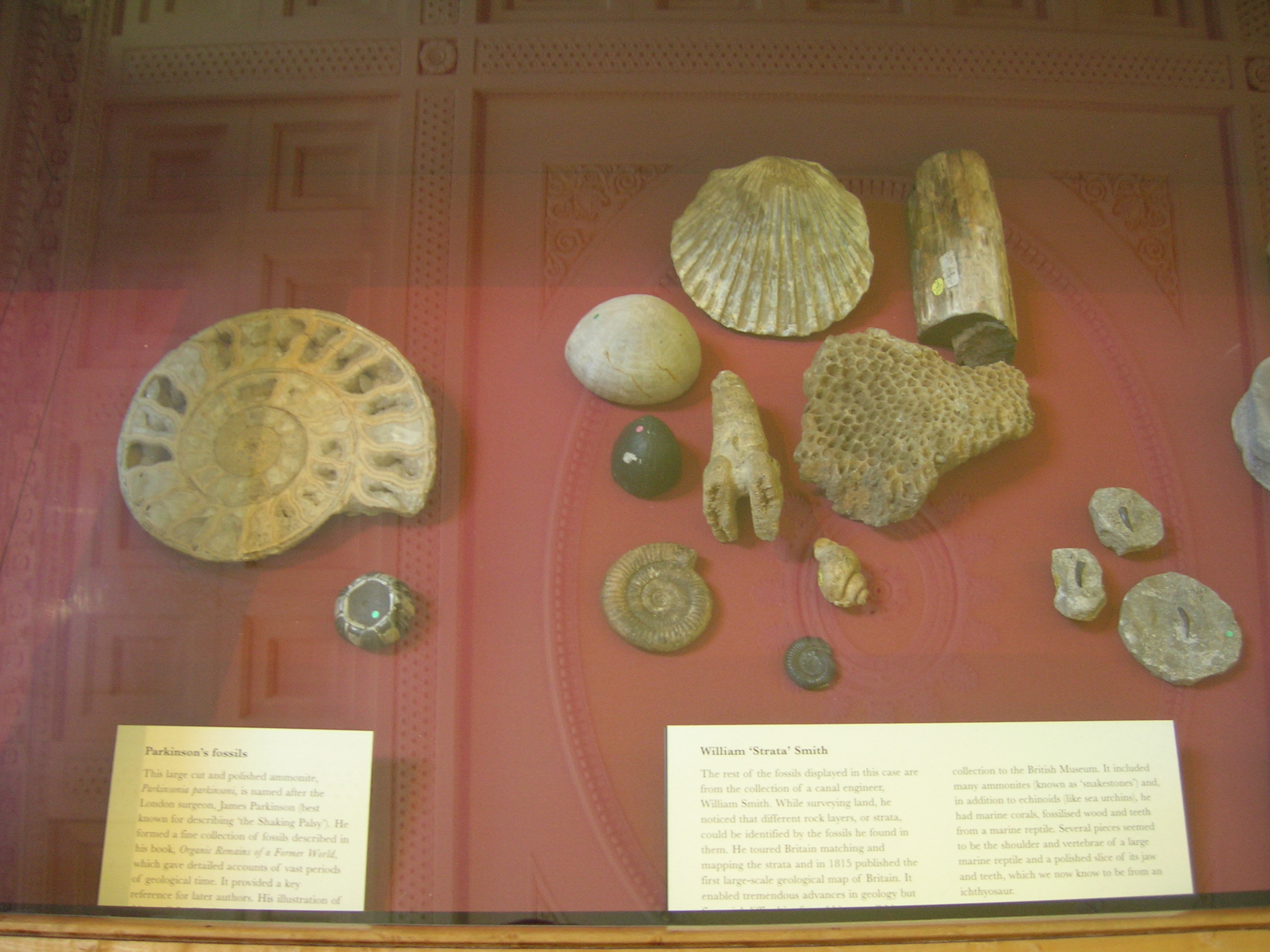
On the right: William ?Strata' Smith (geologist) The rest of the fossils displayed in this case are from the collection of a canal engineer, William Smith. While surveying land, he noticed that different rock layers, or strata, could be identified by the fossils he found in them. He toured Britain matching and mapping the strata and in 1815 published the first large-scale geological map of Britain. It enabled tremendous advances in geology? Collection to the British Museum. It included many ammonites (known as ?snakestones?) in addition to echinoids (like sea urchins); he had marine corals, fossilized wood and teeth from a marine reptile. On the left: Parkinson?s fossils This large cut and polished ammonite, Parkinsonia parkinsoni is named after James Parkinson , (best known for having described ?the Shaking Palsy? ?Parkinson?s Disease?). He formed a fine collection of fossils described in his book Organic Remains of a Former World, which gave detailed accounts of vast periods of geological time. It provided a key reference for later authors. |
| Date | |
| Source |
Fossils that helped develop the first geological map
|
| Author | J Brew |
| Camera location | | View this and other nearby images on: OpenStreetMap |
|---|
Licensing
- You are free:
- to share – to copy, distribute and transmit the work
- to remix – to adapt the work
- Under the following conditions:
- attribution – You must give appropriate credit, provide a link to the license, and indicate if changes were made. You may do so in any reasonable manner, but not in any way that suggests the licensor endorses you or your use.
- share alike – If you remix, transform, or build upon the material, you must distribute your contributions under the same or compatible license as the original.
| This image, originally posted to Flickr, was reviewed on June 6, 2009 by the administrator or reviewer File Upload Bot (Magnus Manske), who confirmed that it was available on Flickr under the stated license on that date. |
File history
Click on a date/time to view the file as it appeared at that time.
| Date/Time | Thumbnail | Dimensions | User | Comment | |
|---|---|---|---|---|---|
| current | 13:42, 6 June 2009 | | 2,592 × 1,944 (1.13 MB) | commons>File Upload Bot (Magnus Manske) | {{Information |Description= On the right: [http://en.wikipedia.org/wiki/William_Smith_(geologist) William ?Strata' Smith (geologist)] The rest of the fossils displayed in this case are from the collection of a canal engineer, William Smith. While survey |
File usage
There are no pages that use this file.