File:Fort Lyon Diagram.jpg
Jump to navigation
Jump to search

Size of this preview: 800 × 506 pixels. Other resolutions: 320 × 202 pixels | 640 × 404 pixels | 1,024 × 647 pixels | 1,280 × 809 pixels | 2,560 × 1,618 pixels | 4,203 × 2,656 pixels.
Original file (4,203 × 2,656 pixels, file size: 11.51 MB, MIME type: image/jpeg)
File history
Click on a date/time to view the file as it appeared at that time.
| Date/Time | Thumbnail | Dimensions | User | Comment | |
|---|---|---|---|---|---|
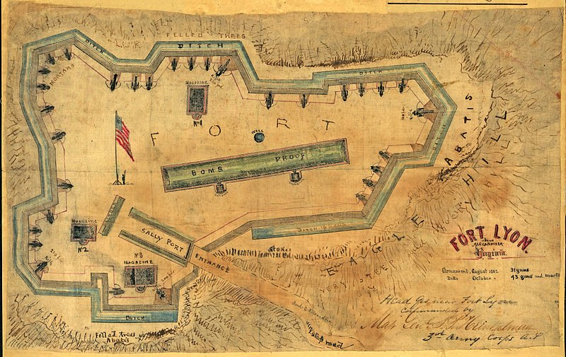
| current | 22:31, 3 February 2009 | | 4,203 × 2,656 (11.51 MB) | commons>File Upload Bot (Magnus Manske) | {{BotMoveToCommons|en.wikipedia}} {{Information |Description={{en|The map shows a close up drawing of Fort Lyon located on Eagle Hill in Alexandria, Virginia. Shows the fort's defenses, including abatis, ditches, salients, sally port, and bomb proof. Sn |
File usage
There are no pages that use this file.