File:FortTiconderogaLayout1758.png
Jump to navigation
Jump to search
Size of this preview: 800 × 518 pixels. Other resolutions: 320 × 207 pixels | 640 × 414 pixels | 1,024 × 663 pixels | 1,327 × 859 pixels.
Original file (1,327 × 859 pixels, file size: 2.42 MB, MIME type: image/png)
File history
Click on a date/time to view the file as it appeared at that time.
| Date/Time | Thumbnail | Dimensions | User | Comment | |
|---|---|---|---|---|---|
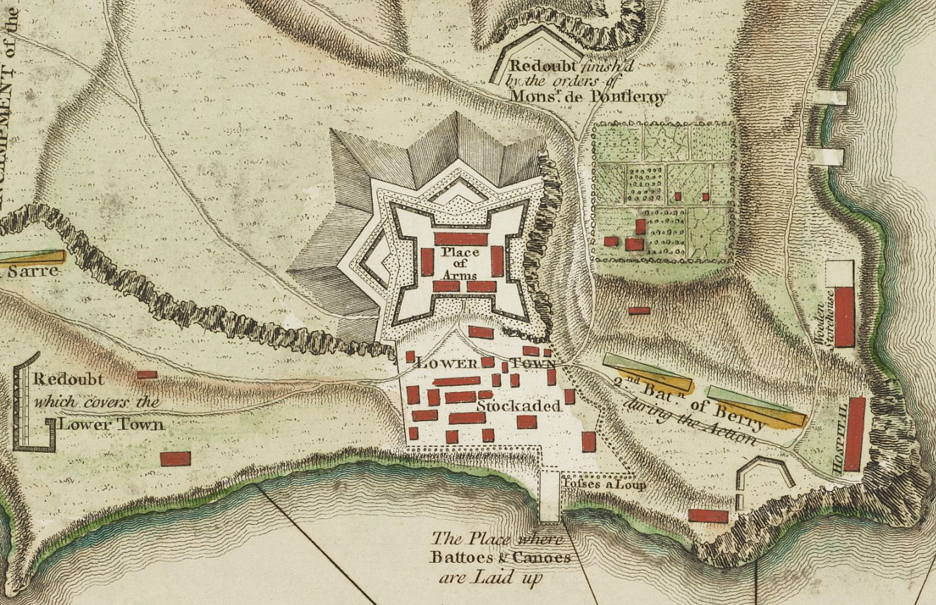
| current | 16:17, 10 February 2009 | | 1,327 × 859 (2.42 MB) | commons>Magicpiano | {{Information |Description={{en|1=This is a period map showing the forces arrayed at the Battle of Carillon at Fort Ticonderoga (then known as Fort Carillon) in 1758. It is captioned ''A Plan of the Town |
File usage
There are no pages that use this file.