File:Former Canadian National Railway Station-Maple GO Station-30 Station Street-Maple-Ontario-HPC6765-20201031.jpg
Jump to navigation
Jump to search

Size of this preview: 800 × 580 pixels. Other resolutions: 320 × 232 pixels | 640 × 464 pixels | 1,024 × 742 pixels | 1,280 × 928 pixels | 2,560 × 1,856 pixels | 3,501 × 2,538 pixels.
Original file (3,501 × 2,538 pixels, file size: 1.84 MB, MIME type: image/jpeg)
Summary
| Description |
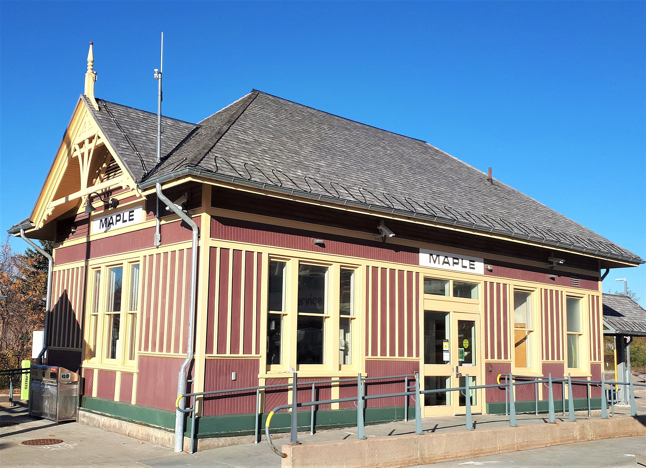
English: Former Canadian National Railway Station was built in 1903 to designs prepared by the Grand Trunk Railway (GTR), which was later acquired by the Canadian National Railways (CNR). It is a small one-storey wooden Queen Anne building. The heritage value of the Maple station resides in the high degree of integrity, spatial organization, domestic scale, wooden detailing, functional organization, and in its evocative rural setting.
|
This photo is of a cultural heritage site in Canada, number 6765
|
|
| Date | |
| Source | Own work |
| Author | Mhsheikholeslami |
| Camera location | | View this and other nearby images on: OpenStreetMap |
|---|
![]()
This photo is of a site in the Ontario Heritage Act Register, with site identifier
Licensing
I, the copyright holder of this work, hereby publish it under the following license:
This file is licensed under the Creative Commons Attribution-Share Alike 4.0 International license.
- You are free:
- to share – to copy, distribute and transmit the work
- to remix – to adapt the work
- Under the following conditions:
- attribution – You must give appropriate credit, provide a link to the license, and indicate if changes were made. You may do so in any reasonable manner, but not in any way that suggests the licensor endorses you or your use.
- share alike – If you remix, transform, or build upon the material, you must distribute your contributions under the same or compatible license as the original.

|
This image was uploaded as part of Wiki Loves Monuments 2020.
|
File history
Click on a date/time to view the file as it appeared at that time.
| Date/Time | Thumbnail | Dimensions | User | Comment | |
|---|---|---|---|---|---|
| current | 21:15, 31 October 2020 | | 3,501 × 2,538 (1.84 MB) | commons>Mhsheikholeslami | Uploaded own work with UploadWizard |
File usage
There are no pages that use this file.