File:Flag-map of the world (1914).png
Jump to navigation
Jump to search
Size of this preview: 800 × 397 pixels. Other resolutions: 320 × 159 pixels | 640 × 318 pixels | 1,024 × 508 pixels | 1,280 × 635 pixels | 2,560 × 1,271 pixels | 4,500 × 2,234 pixels.
Original file (4,500 × 2,234 pixels, file size: 529 KB, MIME type: image/png)
.png)

|
This flag map image could be re-created using vector graphics as an SVG file. This has several advantages; see Commons:Media for cleanup for more information. If an SVG form of this image is available, please upload it and afterwards replace this template with
{{vector version available|new image name}}.
It is recommended to name the SVG file “Flag-map of the world (1914).svg”—then the template Vector version available (or Vva) does not need the new image name parameter. |
Summary
| Description |
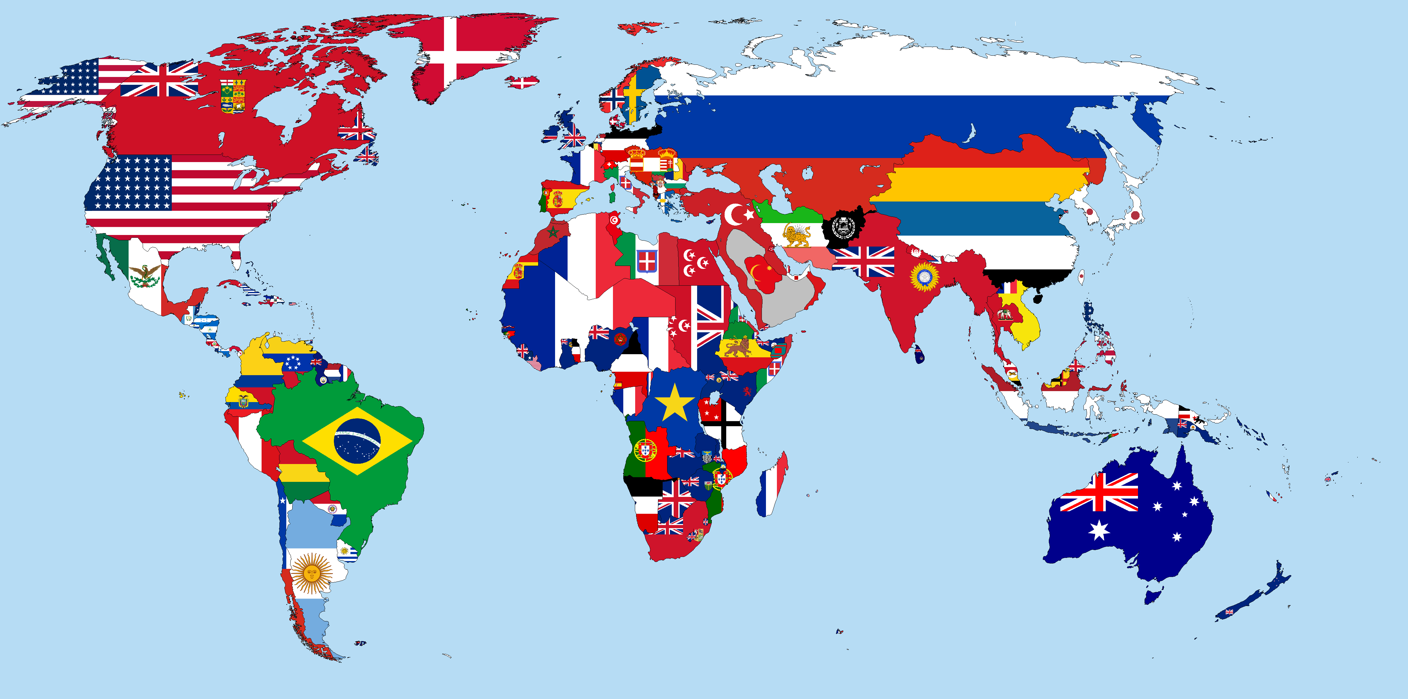
English: This is a world map in 1914, which shows flags of countries and colonies covering their territory. It is in Kavrayskiy VII projection.
|
|||||
| Date | ||||||
| Source | Own work | |||||
| Author | Alvin Lee | |||||
.png)
.png)
.png)
.png)
.png)
.png)
.png)
.png)
.png)
.png)
.png)
.png)
.png)
.png)
.png)
.png)
.png)
.png)
.png)
.png)
.png)
.png)
.png)
.png)
.png)
.png)
.png)
.png)
.png)
Licensing
I, the copyright holder of this work, hereby publish it under the following license:
This file is licensed under the Creative Commons Attribution-Share Alike 3.0 Unported license.
- You are free:
- to share – to copy, distribute and transmit the work
- to remix – to adapt the work
- Under the following conditions:
- attribution – You must give appropriate credit, provide a link to the license, and indicate if changes were made. You may do so in any reasonable manner, but not in any way that suggests the licensor endorses you or your use.
- share alike – If you remix, transform, or build upon the material, you must distribute your contributions under the same or compatible license as the original.
File history
Click on a date/time to view the file as it appeared at that time.
| Date/Time | Thumbnail | Dimensions | User | Comment | |
|---|---|---|---|---|---|
| current | 00:28, 11 August 2023 | | 4,500 × 2,234 (529 KB) | commons>Поль Крол Злой Диктатор | Reverted to version as of 19:08, 28 February 2023 (UTC) |
File usage
There are no pages that use this file.
.png)