File:Fitchburg Cutoff modern status map.svg
Jump to navigation
Jump to search

Size of this PNG preview of this SVG file: 800 × 497 pixels. Other resolutions: 320 × 199 pixels | 640 × 398 pixels | 1,024 × 637 pixels | 1,280 × 796 pixels | 2,560 × 1,591 pixels | 1,850 × 1,150 pixels.
Original file (SVG file, nominally 1,850 × 1,150 pixels, file size: 39 KB)
File history
Click on a date/time to view the file as it appeared at that time.
| Date/Time | Thumbnail | Dimensions | User | Comment | |
|---|---|---|---|---|---|
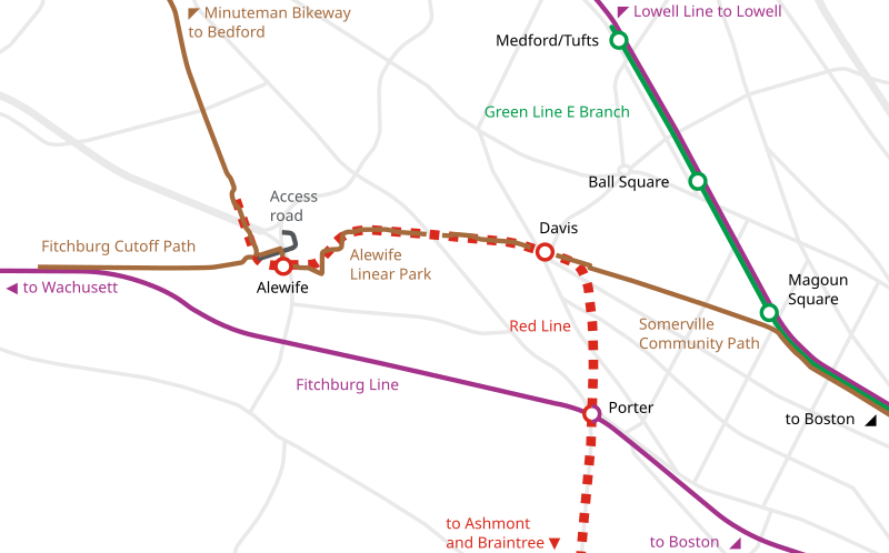
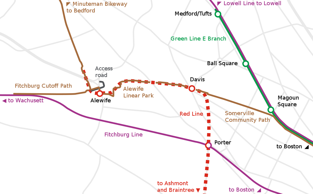
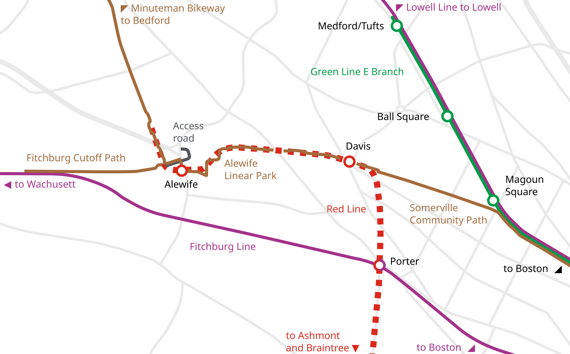
| current | 20:26, 30 August 2022 | | 1,850 × 1,150 (39 KB) | commons>Pi.1415926535 | == {{int:filedesc}} == {{Information |Description ={{en|1=Map showing the modern reuse of the Fitchburg Cutoff alignment, including several trails as well as the MBTA Red Line tunnel}} |Source = {{own}} |Author = Pi.1415926535 |Date = 2022 |Permission = |other_versions = }} == {{int:license-header}} == {{self|cc-by-sa-4.0|GFDL}} Category:Maps by User:Pi.1415926535 Category:Alewife Linear Park [[Category:Somerville Community Pat... |
File usage
There are no pages that use this file.