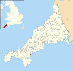
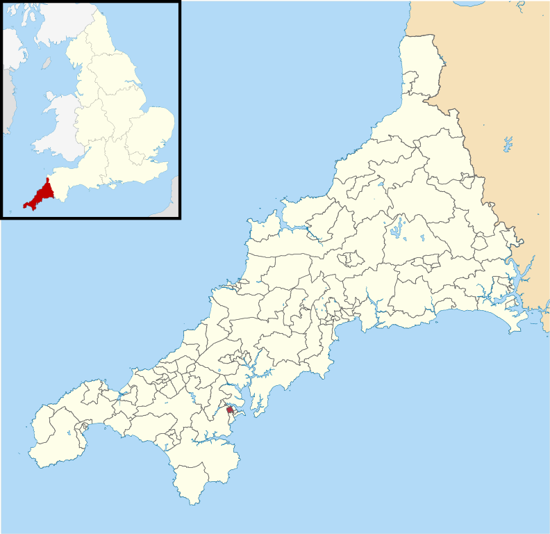
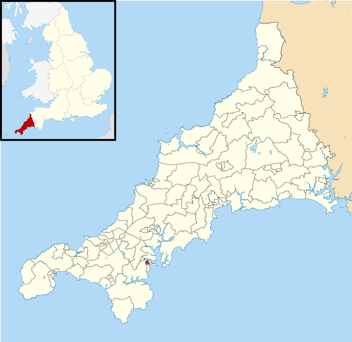
File:Falmouth Trescobeas electoral division map 2013.svg
Jump to navigation
Jump to search

Size of this PNG preview of this SVG file: 618 × 599 pixels. Other resolutions: 247 × 240 pixels | 495 × 480 pixels | 792 × 768 pixels | 1,056 × 1,024 pixels | 2,112 × 2,048 pixels | 1,227 × 1,190 pixels.
Original file (SVG file, nominally 1,227 × 1,190 pixels, file size: 1.6 MB)
File history
Click on a date/time to view the file as it appeared at that time.
| Date/Time | Thumbnail | Dimensions | User | Comment | |
|---|---|---|---|---|---|
| current | 18:47, 25 February 2021 | | 1,227 × 1,190 (1.6 MB) | commons>Gazamp | == {{int:filedesc}} == {{Information |Description=Falmouth Trescobeas electoral division shown within Cornwall |Source={{Derived from|Cornwall UK mainland electoral division map 2013 (blank).svg|display=50}} |Date=2021-02-25 18:46 (UTC) |Author=* File:Cornwall UK mainland electoral division map 2013 (blank).svg: Nilfanion, created using Ordnance Survey data * derivative work: [[User:{{subst:REVISIONUSER}... |
.svg)
File usage
There are no pages that use this file.