File:Extent of the Hansa.png
Jump to navigation
Jump to search

Size of this preview: 800 × 445 pixels. Other resolutions: 320 × 178 pixels | 640 × 356 pixels | 1,250 × 695 pixels.
Original file (1,250 × 695 pixels, file size: 141 KB, MIME type: image/png)
File history
Click on a date/time to view the file as it appeared at that time.
| Date/Time | Thumbnail | Dimensions | User | Comment | |
|---|---|---|---|---|---|
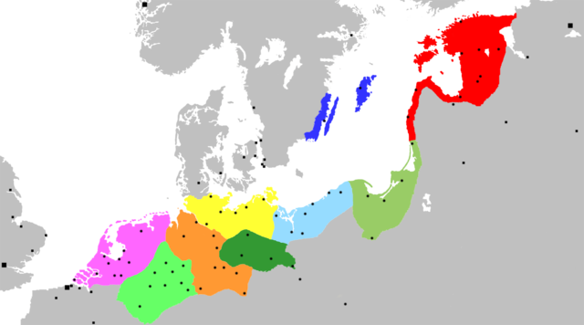
| current | 00:12, 20 November 2007 | | 1,250 × 695 (141 KB) | commons>OwenBlacker | {{Information |Description= Map of the Hanseatic League, circa 1400, showing Circles, ''Kontore'' and principal Hanseatic cities |Source= Adapted from Image:Extent of the Hansa.jpg |Date=~~~~~ |Author=~~~ |Permission={{PD-self}} |other_versio |
File usage
There are no pages that use this file.