File:Europe map 1812-14 in Rus.png
Jump to navigation
Jump to search
No higher resolution available.
Europe_map_1812-14_in_Rus.png (800 × 565 pixels, file size: 81 KB, MIME type: image/png)
File history
Click on a date/time to view the file as it appeared at that time.
| Date/Time | Thumbnail | Dimensions | User | Comment | |
|---|---|---|---|---|---|
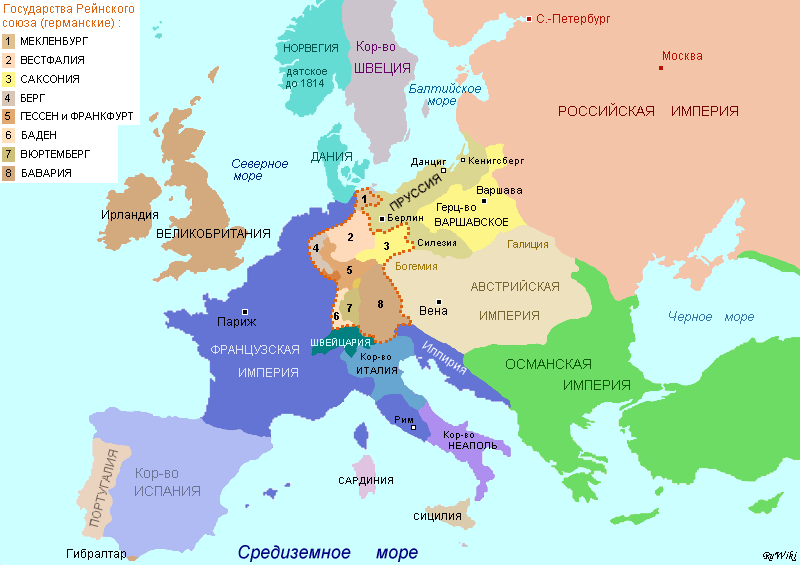
| current | 12:58, 23 December 2007 | | 800 × 565 (81 KB) | commons>Vissarion | {{Information |Description=Europe map in 1812—1814 based on borders from historical maps. Границы государств нанесены в соответствии с более подробными историческими картами, от |
File usage
There are no pages that use this file.