File:Europe in 1812.PNG
Jump to navigation
Jump to search
No higher resolution available.
Europe_in_1812.PNG (536 × 399 pixels, file size: 458 KB, MIME type: image/png)
File history
Click on a date/time to view the file as it appeared at that time.
| Date/Time | Thumbnail | Dimensions | User | Comment | |
|---|---|---|---|---|---|
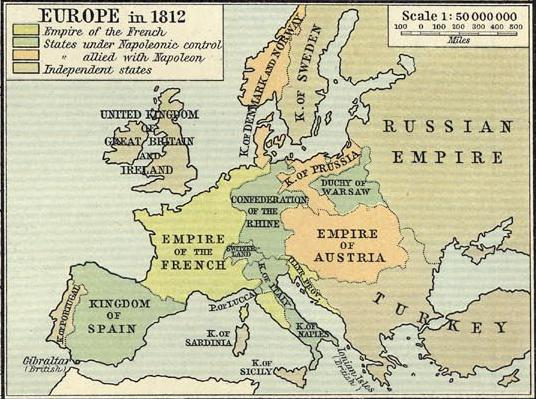
| current | 16:58, 28 January 2009 | | 536 × 399 (458 KB) | commons>R'n'B | {{Information |Description={{en|1=Political map of Europe in 1812, showing boundaries immediately prior to Napoleon's invasion of Russia}} |Source=Historical Atlas. New York: Henry Holt and Company copy available at http://www.lib.utexas.edu/maps/historic |
File usage
There are no pages that use this file.