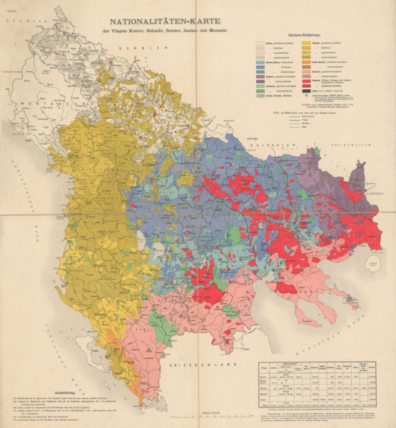
File:Ethnographic map of the central Balkans, ca. 1900.png
Jump to navigation
Jump to search

Size of this preview: 555 × 600 pixels. Other resolutions: 222 × 240 pixels | 444 × 480 pixels | 711 × 768 pixels | 947 × 1,024 pixels | 1,720 × 1,859 pixels.
Original file (1,720 × 1,859 pixels, file size: 6.42 MB, MIME type: image/png)
File history
Click on a date/time to view the file as it appeared at that time.
| Date/Time | Thumbnail | Dimensions | User | Comment | |
|---|---|---|---|---|---|
| current | 02:00, 11 July 2021 | | 1,720 × 1,859 (6.42 MB) | commons>Kromid | Uploaded a work by Institute and Museum of Military History • B III c • B III Balkán-félsziget • B I–XV. Európa - Unknown Author from https://maps.hungaricana.hu/en/HTITerkeptar/22375/ with UploadWizard |
File usage
There are no pages that use this file.