File:Eibsee-Talstation.jpg
From WikiProjectMed
Jump to navigation
Jump to search
![File:Eibsee-Talstation.jpg](https://upload.wikimedia.org/wikipedia/commons/thumb/e/e5/Eibsee-Talstation.jpg/800px-Eibsee-Talstation.jpg)
Size of this preview: 800 × 450 pixels. Other resolutions: 320 × 180 pixels | 640 × 360 pixels | 1,024 × 576 pixels | 1,280 × 720 pixels | 2,560 × 1,440 pixels | 6,000 × 3,376 pixels.
Original file (6,000 × 3,376 pixels, file size: 4.33 MB, MIME type: image/jpeg)
This file is from a shared repository and may be used by other projects. The description on its file description page there is shown below.
Summary
Germany
Bavaria
Landkreis GAP
Grainau - Wetterstein 998 m ü. NHN
DescriptionEibsee-Talstation.jpg |
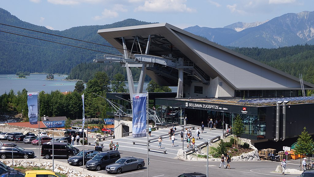
Deutsch: Talstation der Seilbahn Zugspitze am Eibsee. |
Date | Taken on 4 August 2018, 12:43:14 |
Source | Own work |
Author | FkMohr |
Camera location | 47° 27′ 22.11″ N, 10° 59′ 36.33″ E ![]() ![]() | View this and other nearby images on: OpenStreetMap | ![]() |
---|
BY {XF180804-1243}
Licensing
Friedrich-Karl Mohr, the copyright holder of this work, hereby publishes it under the following license:
![w:en:Creative Commons](https://upload.wikimedia.org/wikipedia/commons/thumb/7/79/CC_some_rights_reserved.svg/90px-CC_some_rights_reserved.svg.png)
![attribution](https://upload.wikimedia.org/wikipedia/commons/thumb/1/11/Cc-by_new_white.svg/24px-Cc-by_new_white.svg.png)
![share alike](https://upload.wikimedia.org/wikipedia/commons/thumb/d/df/Cc-sa_white.svg/24px-Cc-sa_white.svg.png)
This file is licensed under the Creative Commons Attribution-Share Alike 3.0 Germany license.
Attribution: Friedrich-Karl Mohr
- You are free:
- to share – to copy, distribute and transmit the work
- to remix – to adapt the work
- Under the following conditions:
- attribution – You must give appropriate credit, provide a link to the license, and indicate if changes were made. You may do so in any reasonable manner, but not in any way that suggests the licensor endorses you or your use.
- share alike – If you remix, transform, or build upon the material, you must distribute your contributions under the same or compatible license as the original.
![](https://upload.wikimedia.org/wikipedia/commons/thumb/b/ba/Flag_of_Germany.svg/90px-Flag_of_Germany.svg.png)
Captions
Add a one-line explanation of what this file represents
Wetterstein [BY] 998 m ü. NHN
Items portrayed in this file
depicts
4 August 2018
47°27'22.111"N, 10°59'36.330"E
image/jpeg
455424290076a4544270cd361a3755cb16118fc6
4,538,469 byte
3,376 pixel
6,000 pixel
0.00625 second
13
35 millimetre
100
File history
Click on a date/time to view the file as it appeared at that time.
Date/Time | Thumbnail | Dimensions | User | Comment | |
---|---|---|---|---|---|
current | 14:58, 9 August 2018 | ![]() | 6,000 × 3,376 (4.33 MB) | commons>FkMohr | User created page with UploadWizard |
File usage
There are no pages that use this file.
Metadata
This file contains additional information, probably added from the digital camera or scanner used to create or digitize it.
If the file has been modified from its original state, some details may not fully reflect the modified file.
Image title |
|
---|---|
Camera manufacturer | SONY |
Camera model | SLT-A65V |
Author | DSC03305;Friedo |
Copyright holder |
|
Exposure time | 1/160 sec (0.00625) |
F Number | f/13 |
ISO speed rating | 100 |
Date and time of data generation | 12:43, 4 August 2018 |
Lens focal length | 35 mm |
Latitude | 47° 27′ 22.11″ N |
Longitude | 10° 59′ 36.33″ E |
Altitude | 1,008 meters above sea level |
Short title |
|
City shown | Wetterstein |
Orientation | Normal |
Horizontal resolution | 350 dpi |
Vertical resolution | 350 dpi |
Software used | SLT-A65V v1.04 |
File change date and time | 12:43, 4 August 2018 |
Y and C positioning | Co-sited |
Exposure Program | Normal program |
Exif version | 2.3 |
Date and time of digitizing | 12:43, 4 August 2018 |
Meaning of each component |
|
Image compression mode | 2 |
APEX brightness | 9.946875 |
APEX exposure bias | 0 |
Maximum land aperture | 4.640625 APEX (f/4.99) |
Metering mode | Pattern |
Light source | Unknown |
Flash | Flash did not fire, compulsory flash suppression |
Supported Flashpix version | 1 |
Color space | sRGB |
File source | Digital still camera |
Scene type | A directly photographed image |
Custom image processing | Normal process |
Exposure mode | Auto exposure |
White balance | Auto white balance |
Focal length in 35 mm film | 52 mm |
Scene capture type | Standard |
Contrast | Normal |
Saturation | Normal |
Sharpness | Normal |
GPS time (atomic clock) | 10:43 |
Receiver status | Measurement in progress |
Measurement mode | 3-dimensional measurement |
Measurement precision | Excellent (1.8679) |
Speed unit | Kilometers per hour |
Speed of GPS receiver | 0.411 |
Reference for direction of movement | True direction |
Direction of movement | 209.74 |
Reference for direction of image | True direction |
Direction of image | 293.87 |
Geodetic survey data used | WGS-84 |
Latitude destination | 47° 27′ 59.69″ N |
Longitude of destination | 10° 57′ 30.64″ E |
GPS date | 4 August 2018 |
GPS differential correction | 0 |
GPS tag version | 2.3.0.0 |
Supported Flashpix version | 1 |
Image width | 6,000 px |
Image height | 3,376 px |
Compression scheme | JPEG (old) |
Code for country shown | DEU |
Sublocation of city shown | Eibsee |
Country shown | Deutschland |
Province or state shown | Bayern |
IIM version | 4 |
Retrieved from "https://mdwiki.org/wiki/File:Eibsee-Talstation.jpg"