File:Dullesairportmap.png
Jump to navigation
Jump to search

Size of this preview: 600 × 600 pixels. Other resolutions: 240 × 240 pixels | 480 × 480 pixels | 1,000 × 1,000 pixels.
Original file (1,000 × 1,000 pixels, file size: 494 KB, MIME type: image/png)
File history
Click on a date/time to view the file as it appeared at that time.
| Date/Time | Thumbnail | Dimensions | User | Comment | |
|---|---|---|---|---|---|
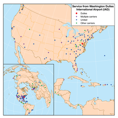
| current | 00:54, 21 February 2007 | | 1,000 × 1,000 (494 KB) | commons>Kmusser | This is a route map for Washington Dulles International Airport as of February 2007. Map is an Azimuthal equidistant projection centered on the airport so straight lines from Dulles are along great circle routes. United includes United Expre |
File usage
There are no pages that use this file.