File:Drawehn.png
Jump to navigation
Jump to search
Size of this preview: 511 × 599 pixels. Other resolutions: 205 × 240 pixels | 409 × 480 pixels | 775 × 909 pixels.
Original file (775 × 909 pixels, file size: 76 KB, MIME type: image/png)
File history
Click on a date/time to view the file as it appeared at that time.
| Date/Time | Thumbnail | Dimensions | User | Comment | |
|---|---|---|---|---|---|
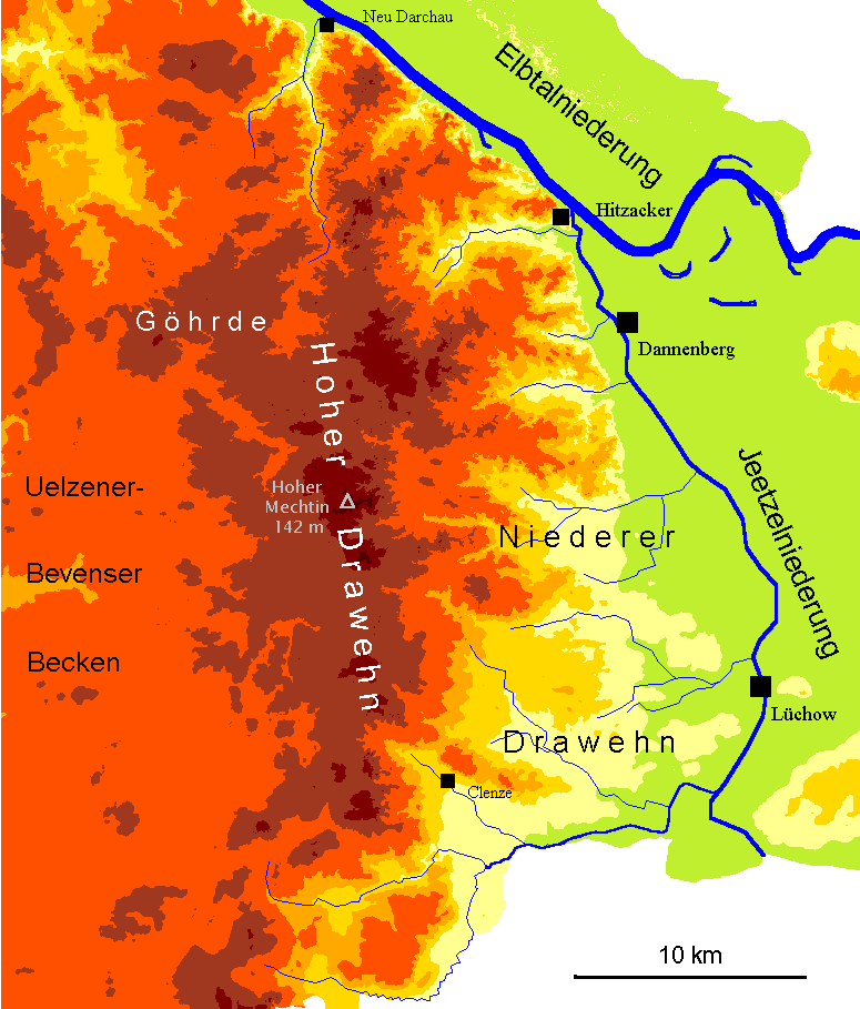
| current | 20:11, 30 August 2007 | | 775 × 909 (76 KB) | commons>Fice | {{Information| |Description= '''''English:''''' Map of the hilly region "Drawehn" between Hamburg and Berlin (North German Lowland). Map has a German inscription. '''''Deutsch:''''' Karte des Drawehn mit Hervorhebung von Höhenschichten (geomorpholog |
File usage
There are no pages that use this file.