File:Donji Kraji per Mrgic on relief map of Bosnia-Herzeg.png
Jump to navigation
Jump to search
Size of this preview: 635 × 599 pixels. Other resolutions: 254 × 240 pixels | 509 × 480 pixels | 814 × 768 pixels | 1,085 × 1,024 pixels | 2,000 × 1,887 pixels.
Original file (2,000 × 1,887 pixels, file size: 6.26 MB, MIME type: image/png)
Summary
| Description |
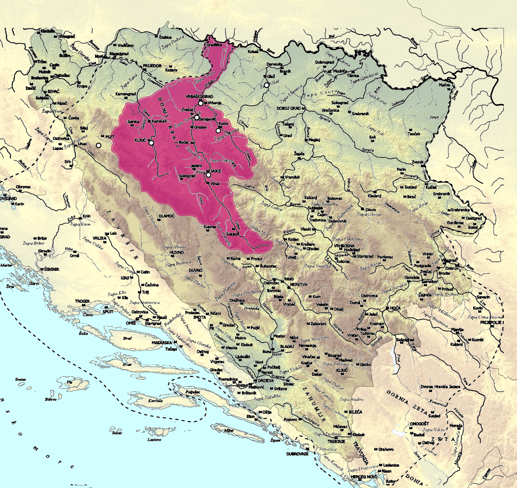
English: Map of Donji Kraji county of medieval Bosnia, per Jelena Mrgić seminal work (2002). "Donji Kraji: Krajina srednjovekovne Bosne". Belgrade: Faculty of Philosophy.
Map is created using svg. relief location map of Bosnia-Herzegovina (File:Bosnia and Herzegovina relief location map.svg) with graphic layer superimposed. |
| Date | |
| Source | Own work |
| Author | Santasa99 |
Licensing
I, the copyright holder of this work, hereby publish it under the following license:
This file is licensed under the Creative Commons Attribution-Share Alike 4.0 International license.
- You are free:
- to share – to copy, distribute and transmit the work
- to remix – to adapt the work
- Under the following conditions:
- attribution – You must give appropriate credit, provide a link to the license, and indicate if changes were made. You may do so in any reasonable manner, but not in any way that suggests the licensor endorses you or your use.
- share alike – If you remix, transform, or build upon the material, you must distribute your contributions under the same or compatible license as the original.
File history
Click on a date/time to view the file as it appeared at that time.
| Date/Time | Thumbnail | Dimensions | User | Comment | |
|---|---|---|---|---|---|
| current | 10:10, 23 April 2020 | | 2,000 × 1,887 (6.26 MB) | commons>Santasa99 | Uploaded own work with UploadWizard |
File usage
There are no pages that use this file.