File:Deutsch Ostafrika.PNG

Original file (701 × 764 pixels, file size: 1.32 MB, MIME type: image/png)
Summary
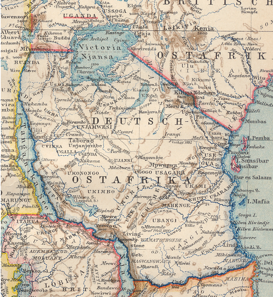
| Description | Map of German East Africa (March 1894) |
| Date | |
| Source | Brockhaus atlas (1894) |
| Author |
Licensing
|
This work is in the public domain in its country of origin and other countries and areas where the copyright term is the author's life plus 70 years or fewer.
| |
| This file has been identified as being free of known restrictions under copyright law, including all related and neighboring rights. | |
File history
Click on a date/time to view the file as it appeared at that time.
| Date/Time | Thumbnail | Dimensions | User | Comment | |
|---|---|---|---|---|---|
| current | 13:05, 8 July 2007 | | 701 × 764 (1.32 MB) | commons>Ivan1111 | {{Information |Description= Map of German East Africa (March 1894) |Source= Brockhaus atlas (1894) |Date= March 1894 |Author= |Permission= |other_versions= }} |
File usage
There are no pages that use this file.